Approximate Location Map
Large Map »
Latitude: 51.7513 / 51°45'4"N
Longitude: -1.2528 / 1°15'10"W
OS Eastings: 451675
OS Northings: 206113
OS Grid: SP516061
Mapcode National: GBR 8Z4.232
Mapcode Global: VHCXV.77JR
Plus Code: 9C3WQP2W+GV
Entry Name: Corpus Christi College, New Block
Listing Date: 28 June 1972
Grade: II
Source: Historic England
Source ID: 1046717
English Heritage Legacy ID: 244912
ID on this website: 101046717
Location: Oxford, Oxfordshire, OX1
County: Oxfordshire
District: Oxford
Electoral Ward/Division: Holywell
Parish: Non Civil Parish
Built-Up Area: Oxford
Traditional County: Oxfordshire
Lieutenancy Area (Ceremonial County): Oxfordshire
Church of England Parish: Oxford St Mary the Virgin with St Cross with St Peter-in-the-East,
Church of England Diocese: Oxford
Tagged with: Building
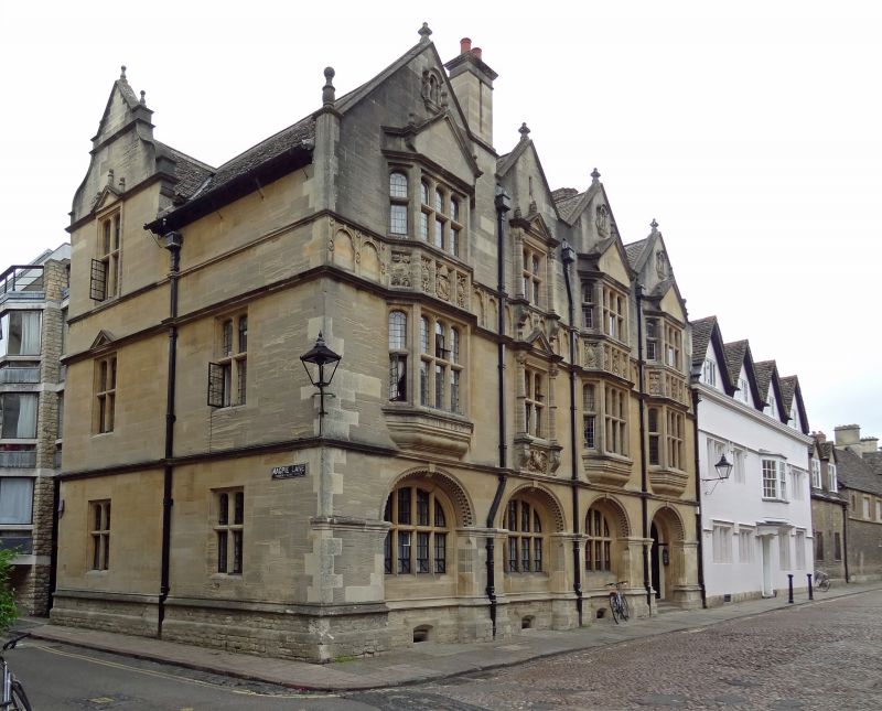
CORPUS CHRISTI COLLEGE
1.
1485
New Block (on corner of
Magpie Lane and
Merton Street)
SP 5l06 SE 9/464N
II
2.
1884-5, dated by Sir T G Jackson. Doulting stone. Enlarged 1927. 3 storeys,
4 bay front.
Listing NGR: SP5163006024
External links are from the relevant listing authority and, where applicable, Wikidata. Wikidata IDs may be related buildings as well as this specific building. If you want to add or update a link, you will need to do so by editing the Wikidata entry.


Other nearby listed buildings
