Latitude: 51.7539 / 51°45'14"N
Longitude: -1.2567 / 1°15'23"W
OS Eastings: 451407
OS Northings: 206400
OS Grid: SP514064
Mapcode National: GBR 8YY.TB8
Mapcode Global: VHCXV.55HR
Plus Code: 9C3WQP3V+H8
Entry Name: 16, Turl Street
Listing Date: 28 June 1972
Grade: II
Source: Historic England
Source ID: 1047098
English Heritage Legacy ID: 245923
ID on this website: 101047098
Location: Oxford, Oxfordshire, OX1
County: Oxfordshire
District: Oxford
Electoral Ward/Division: Carfax
Parish: Non Civil Parish
Built-Up Area: Oxford
Traditional County: Oxfordshire
Lieutenancy Area (Ceremonial County): Oxfordshire
Church of England Parish: Oxford St Michael and St Martin and All Saints
Church of England Diocese: Oxford
Tagged with: Building
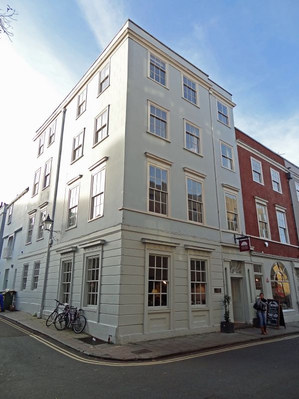
TURL STREET
1.
1485
(West Side)
No 16
SP 5106 SW 8/151
II
2.
House and restaurant. On the corner of Ship Street. C18-C19 front of 4-storeyed
stucco with a rusticated ground floor with a moulded cornice
369
and parapet. There are cellars and it is possible that the core of the house
at the back and running up Ship Street may be a date after about 1785 when
the Turl was widened at the North end. The East elevation has in the upper
floors 3 sash windows with moulded cornices, some being blocked. The ground
floor has 2 moulded window frames with architraves having paterae on them.
The early C19 doorway has a good fanlight. The South elevation on Ship Street
has sash windows similar to those on the East and the one in the 1st floor
has an iron balcony and a blind box.
Listing NGR: SP5140006399
External links are from the relevant listing authority and, where applicable, Wikidata. Wikidata IDs may be related buildings as well as this specific building. If you want to add or update a link, you will need to do so by editing the Wikidata entry.


Other nearby listed buildings