Approximate Location Map
Large Map »
Latitude: 51.754 / 51°45'14"N
Longitude: -1.2567 / 1°15'24"W
OS Eastings: 451404
OS Northings: 206410
OS Grid: SP514064
Mapcode National: GBR 8YY.TB7
Mapcode Global: VHCXV.55HP
Plus Code: 9C3WQP3V+J8
Entry Name: 17-19, Turl Street
Listing Date: 28 June 1972
Grade: II
Source: Historic England
Source ID: 1372887
English Heritage Legacy ID: 245924
ID on this website: 101372887
Location: Oxford, Oxfordshire, OX1
County: Oxfordshire
District: Oxford
Electoral Ward/Division: Carfax
Parish: Non Civil Parish
Built-Up Area: Oxford
Traditional County: Oxfordshire
Lieutenancy Area (Ceremonial County): Oxfordshire
Church of England Parish: Oxford St Michael and St Martin and All Saints
Church of England Diocese: Oxford
Tagged with: Building
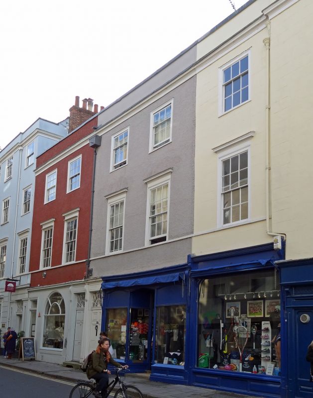
TURL STREET
1.
1485
(West Side)
Nos 17 to 19 (consec)
SP 5106 SW 8/186
II
2.
Houses and shops. A C18-Cl9 front of 3-storeyed roughcast with cellars,
moulded wood cornice and parapet. There are C18 shop fronts. In each floor
are 5 sash windows, those in the 1st floor being tall and having moulded
wood frames and cornices. 6 panel doors with traceried fans. The roof is
not visible from the street.
Listing NGR: SP5140206412
External links are from the relevant listing authority and, where applicable, Wikidata. Wikidata IDs may be related buildings as well as this specific building. If you want to add or update a link, you will need to do so by editing the Wikidata entry.


Other nearby listed buildings
