Latitude: 51.7031 / 51°42'11"N
Longitude: -1.1809 / 1°10'51"W
OS Eastings: 456703
OS Northings: 200804
OS Grid: SP567008
Mapcode National: GBR 8ZT.28N
Mapcode Global: VHCY2.HG27
Plus Code: 9C3WPR39+6M
Entry Name: Court House
Listing Date: 19 August 1986
Grade: II
Source: Historic England
Source ID: 1047997
English Heritage Legacy ID: 248412
ID on this website: 101047997
Location: Toot Baldon, South Oxfordshire, OX44
County: Oxfordshire
District: South Oxfordshire
Civil Parish: Toot Baldon
Traditional County: Oxfordshire
Lieutenancy Area (Ceremonial County): Oxfordshire
Church of England Parish: Marsh Baldon with Toot Baldon and Nuneham Courtenay
Church of England Diocese: Oxford
Tagged with: House
TOOT BALDON SP5600 8/174 Court House
GV II
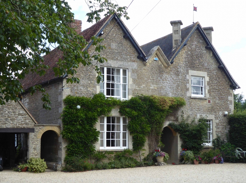
Substantial house. C16, extended mid C19. Coursed limestone rubble with ashlar quoins; old plain-tile roof with brick and stone stacks. Gable-fronted plan of 2 parallel ranges. 2 storeys. Double-gabled 2-window front has an arched doorway, to right of centre, tripartite sashes to left at ground and first floors, and margin-light sashes to right. The right gable has 2 small stone stacks, set diagonally. There is a small stone-coped false gable between the main gables, and a datestone on the left gable inscribed "W.FRUIN/1841". The rear part of the left range is a 3-window Cl6 house, with heavy chamfered plinth, which has, at first floor, sashes flanking a stone-arched window with recessed spandrels and, at ground floor, has a 6-panel door set beneath a stone label and a further sash. The furthermost bay shows signs of first-floor timber framing having been replaced on both sides, and the rear gable wall has a large projecting chimney with sloping weatherings. The right range has a 3-window garden front with further margin-light sashes, those at first floor with gables. Interior: some intersecting chamfered beams. The right range is slightly later than the extension of the left range and the datestone may refer to it. (V.C.H.: Oxfordshire, Vol.V, p.48).
Listing NGR: SP5670300804
External links are from the relevant listing authority and, where applicable, Wikidata. Wikidata IDs may be related buildings as well as this specific building. If you want to add or update a link, you will need to do so by editing the Wikidata entry.


Other nearby listed buildings