Approximate Location Map
Large Map »
Latitude: 51.7738 / 51°46'25"N
Longitude: -1.3133 / 1°18'47"W
OS Eastings: 447478
OS Northings: 208565
OS Grid: SP474085
Mapcode National: GBR 7XB.QT2
Mapcode Global: VHCXM.6P23
Plus Code: 9C3WQMFP+GM
Entry Name: Church of All Saints, Chest Tomb Approximately 10 Metres North West of Porch
Listing Date: 24 June 1987
Grade: II
Source: Historic England
Source ID: 1048276
English Heritage Legacy ID: 249846
ID on this website: 101048276
Location: All Saints' Church, Wytham, Vale of White Horse, Oxfordshire, OX2
County: Oxfordshire
District: Vale of White Horse
Civil Parish: Wytham
Traditional County: Berkshire
Lieutenancy Area (Ceremonial County): Oxfordshire
Church of England Parish: Wytham
Church of England Diocese: Oxford
Tagged with: Chest tomb
WYTHAM
SP4708
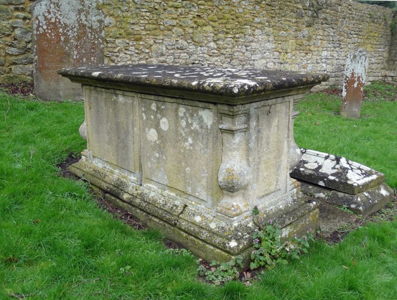
10/169 Church of All Saints, chest
tomb approx. 10m. NW of porch
GV II
Chest tomb. Early C19. Limestone. Moulded plinth and cornice: corner balusters:
2 plain panels each side. Commemorates the Ball family, dated 1826 and 1820.
Listing NGR: SP4748508565
External links are from the relevant listing authority and, where applicable, Wikidata. Wikidata IDs may be related buildings as well as this specific building. If you want to add or update a link, you will need to do so by editing the Wikidata entry.


Other nearby listed buildings
