Approximate Location Map
Large Map »
Latitude: 51.6233 / 51°37'23"N
Longitude: -1.4512 / 1°27'4"W
OS Eastings: 438089
OS Northings: 191746
OS Grid: SU380917
Mapcode National: GBR 6XR.5XF
Mapcode Global: VHC0V.SGPG
Plus Code: 9C3WJGFX+8G
Entry Name: Village Cross Stump
Listing Date: 25 October 1951
Grade: II
Source: Historic England
Source ID: 1048588
English Heritage Legacy ID: 251105
ID on this website: 101048588
Location: Denchworth, Vale of White Horse, Oxfordshire, OX12
County: Oxfordshire
District: Vale of White Horse
Civil Parish: Denchworth
Traditional County: Berkshire
Lieutenancy Area (Ceremonial County): Oxfordshire
Tagged with: High cross
SU39SE
1/11
25/10/51
DENCHWORTH
HYDE ROAD
(East side)
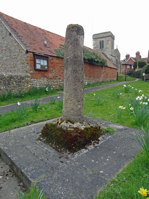
Village Cross Stump
GV
II
Stump of village cross. C14/C15. Limestone stump on base.
Listing NGR: SU3808991746
External links are from the relevant listing authority and, where applicable, Wikidata. Wikidata IDs may be related buildings as well as this specific building. If you want to add or update a link, you will need to do so by editing the Wikidata entry.


Other nearby listed buildings
