Approximate Location Map
Large Map »
Latitude: 52.606 / 52°36'21"N
Longitude: 1.0895 / 1°5'22"E
OS Eastings: 609293
OS Northings: 305393
OS Grid: TG092053
Mapcode National: GBR TF1.L7T
Mapcode Global: WHLSD.PRZK
Plus Code: 9F43J34Q+9Q
Entry Name: Carleton Bridge
Listing Date: 15 August 1983
Grade: II
Source: Historic England
Source ID: 1050744
English Heritage Legacy ID: 226497
ID on this website: 101050744
Location: Carleton Forehoe, South Norfolk, NR9
County: Norfolk
District: South Norfolk
Civil Parish: Wymondham
Traditional County: Norfolk
Lieutenancy Area (Ceremonial County): Norfolk
Church of England Parish: Wymondham
Church of England Diocese: Norwich
Tagged with: Bridge
TG 00 NE KIMBERLEY BARNHAM BROOM ROAD
Carleton Forehoe
3/24
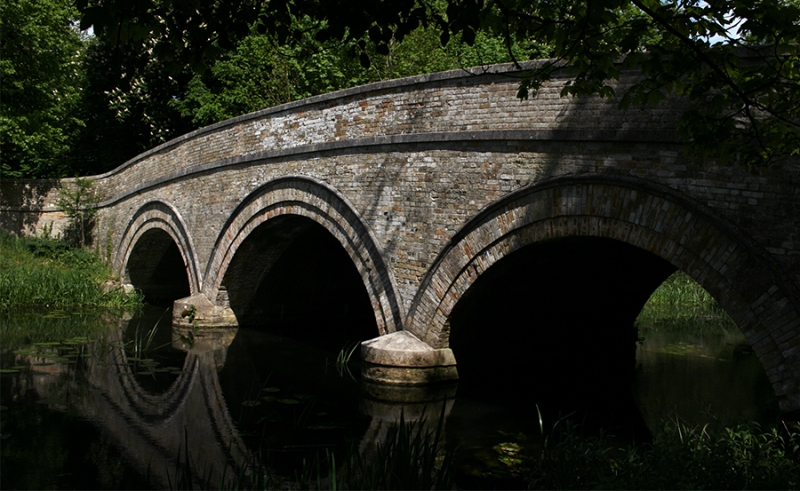
Carleton Bridge
G.V. II
Road bridge over river Yare. 1815 on datestone with Wodehouse crest and motto.
Gault brick with stone dressings. 3 segmental arches of 2 orders with hollow-
chamfered stone hood-moulds. Splayed parapets with stone copings.
Listing NGR: TG0929305393
External links are from the relevant listing authority and, where applicable, Wikidata. Wikidata IDs may be related buildings as well as this specific building. If you want to add or update a link, you will need to do so by editing the Wikidata entry.


Other nearby listed buildings
