Latitude: 51.6423 / 51°38'32"N
Longitude: -1.6589 / 1°39'31"W
OS Eastings: 423702
OS Northings: 193779
OS Grid: SU237937
Mapcode National: GBR 5VS.TPT
Mapcode Global: VHC0K.6ZCC
Plus Code: 9C3WJ8RR+WF
Entry Name: The Radnor Arms Public House
Listing Date: 23 November 1990
Grade: II
Source: Historic England
Source ID: 1052658
English Heritage Legacy ID: 251529
ID on this website: 101052658
Location: Coleshill, Vale of White Horse, Oxfordshire, SN6
County: Oxfordshire
District: Vale of White Horse
Civil Parish: Coleshill
Traditional County: Berkshire
Lieutenancy Area (Ceremonial County): Oxfordshire
Church of England Parish: Coleshill
Church of England Diocese: Oxford
Tagged with: Pub
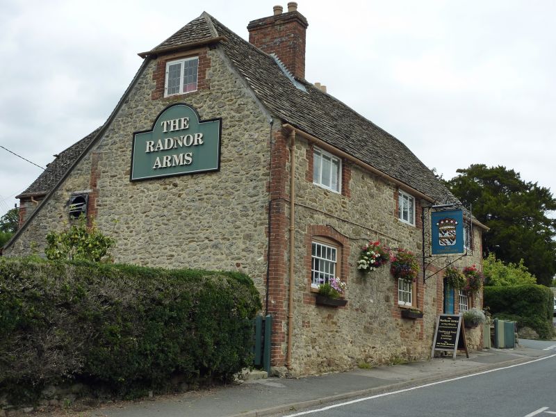
COLESHILL SU2393 The Radnor Arms Public 6/103 House GV II House and smithy now public house. C18, altered and extended C20. Rubble stone with brick dressing; stone-slate roofs with brick stacks. 2-unit plan plus smithy, extended to rear. 2 storeys plus attic. Regular 3-window front has leaded 3-light casements at first floor, but at ground floor has short sashes (5 panes wide) under segmental brick arches with flared headers. Between bays 2 and 3 are 2 blocked doorways with similar heads. Half-hipped roof has ridge stack to right of bay one and a lateral stack to rear of bay 3 (smithy). Gables have attic windows (one now blocked). Central rear wing is probably C20; single-storey range returning from right may be earlier former workshop. Interior: brick forge survives in "Smith Bar". Included for group value.
Listing NGR: SU2370293779
External links are from the relevant listing authority and, where applicable, Wikidata. Wikidata IDs may be related buildings as well as this specific building. If you want to add or update a link, you will need to do so by editing the Wikidata entry.


Other nearby listed buildings