Latitude: 51.6426 / 51°38'33"N
Longitude: -1.6584 / 1°39'30"W
OS Eastings: 423734
OS Northings: 193805
OS Grid: SU237938
Mapcode National: GBR 5VS.TTM
Mapcode Global: VHC0K.6ZM6
Plus Code: 9C3WJ8VR+2J
Entry Name: 33 and 34
Listing Date: 23 November 1990
Grade: II
Source: Historic England
Source ID: 1368144
English Heritage Legacy ID: 251530
ID on this website: 101368144
Location: Coleshill, Vale of White Horse, Oxfordshire, SN6
County: Oxfordshire
District: Vale of White Horse
Civil Parish: Coleshill
Traditional County: Berkshire
Lieutenancy Area (Ceremonial County): Oxfordshire
Church of England Parish: Coleshill
Church of England Diocese: Oxford
Tagged with: Building
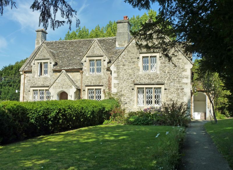
COLESHILL SU2393 Nos 33 and 34 6/61 GV II Pair of semi-detached estate cottages. Circa 1850 for the 2nd Earl of Radnor. Cotswold vernacular style. Rubble stone and dressings with a gabled stone tiled roof and stone stacks. 2 storeys with 2- and 3-light mullioned windows with dripstones and diamond glazing. Gabled porches and plank doors.
Listing NGR: SU2373493805
External links are from the relevant listing authority and, where applicable, Wikidata. Wikidata IDs may be related buildings as well as this specific building. If you want to add or update a link, you will need to do so by editing the Wikidata entry.


Other nearby listed buildings