Latitude: 51.874 / 51°52'26"N
Longitude: -1.4841 / 1°29'2"W
OS Eastings: 435612
OS Northings: 219616
OS Grid: SP356196
Mapcode National: GBR 6TM.HL0
Mapcode Global: VHBZP.7587
Plus Code: 9C3WVGF8+H9
Entry Name: The Old Shop and Attached Railings
Listing Date: 9 October 1980
Last Amended: 18 May 1990
Grade: II
Source: Historic England
Source ID: 1053239
English Heritage Legacy ID: 254191
ID on this website: 101053239
Location: Charlbury, West Oxfordshire, OX7
County: Oxfordshire
District: West Oxfordshire
Civil Parish: Charlbury
Built-Up Area: Charlbury
Traditional County: Oxfordshire
Lieutenancy Area (Ceremonial County): Oxfordshire
Church of England Parish: Charlbury with Shorthampton
Church of England Diocese: Oxford
Tagged with: Building
CHARLBURY DYER'S HILL SP3519 5/50 (South Side) 9/10/80 The Old Shop and attached railings. (formerly listed as The Corner House, Market Street) GV II
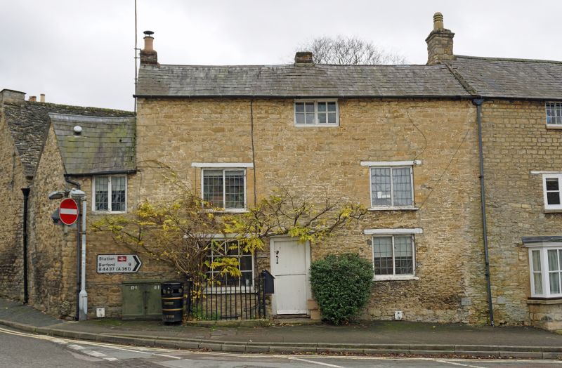
House, subsequently a shop. C18 or earlier with C19 alterations. Random rubble on ground floor, coursed squared rubble above, timber lintels, slate roof. Probably one storey originally later heightened to 3 storeys on cellar. 2-window range. Half-doors to left of centre and former shop window with glazing bars to left under chamfered lintel. Ground and first floor windows have iron-framed casements with rectangular leaded lights. Small second-floor window under eaves has casements with glazing bars. Central ridge chimney and gable-end stack to left. 2-storey C19 extension to left on corner site has one iron-framed casement with leaded lights. Interior not inspected. Small enclosure of spear headed railings with urn finials to standards attached to left of door.
Listing NGR: SP3561119619
External links are from the relevant listing authority and, where applicable, Wikidata. Wikidata IDs may be related buildings as well as this specific building. If you want to add or update a link, you will need to do so by editing the Wikidata entry.


Other nearby listed buildings