Latitude: 51.8742 / 51°52'26"N
Longitude: -1.484 / 1°29'2"W
OS Eastings: 435620
OS Northings: 219635
OS Grid: SP356196
Mapcode National: GBR 6TM.HM1
Mapcode Global: VHBZP.75B3
Plus Code: 9C3WVGF8+MC
Entry Name: White Hart Public House
Listing Date: 9 October 1980
Grade: II
Source: Historic England
Source ID: 1198353
English Heritage Legacy ID: 254208
Also known as: White Hart, Chipping Norton
White Hart
ID on this website: 101198353
Location: Charlbury, West Oxfordshire, OX7
County: Oxfordshire
District: West Oxfordshire
Civil Parish: Charlbury
Built-Up Area: Charlbury
Traditional County: Oxfordshire
Lieutenancy Area (Ceremonial County): Oxfordshire
Church of England Parish: Charlbury with Shorthampton
Church of England Diocese: Oxford
Tagged with: Pub
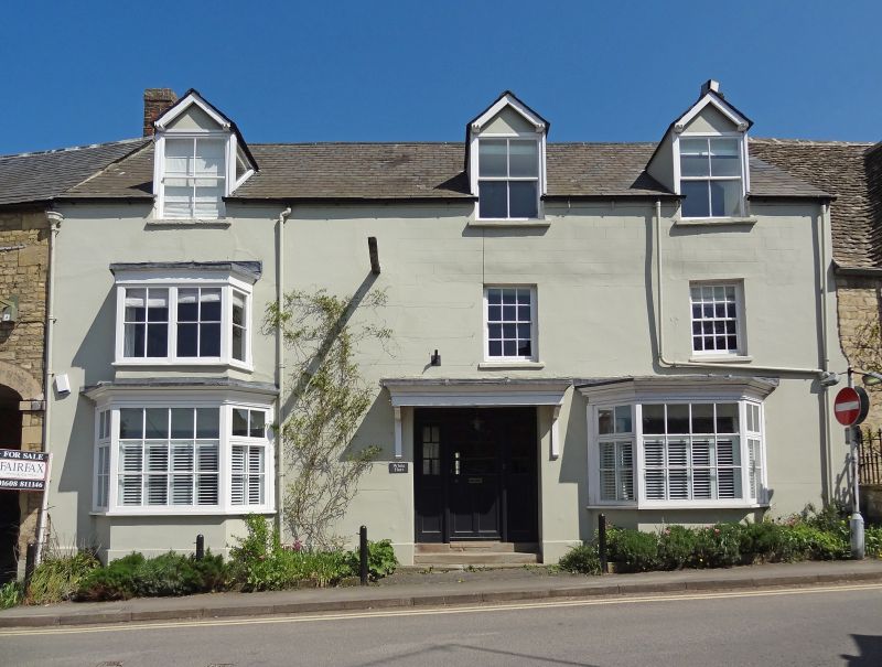
CHARLBURY MARKET STREET SP3519 5/66 (East side) 9/10/80 White Hart Public House GV II
Public house. C17 with C19 additions and alterations. Right part rendered; left part coursed squared rubble; slate roof; 2 brick chimneys. L-plan with lean-to extension to rear. Main part: 2 storeys and attic; 3-window range. C20 half glazed door in centre with side panels under a hood on consoles is flanked by canted ground floor bays. 2 first floor windows to right have sashes with glazing bars; canted bay to left has pair of large-paned sashes with glazing bars. 3 C19 gabled dormers also have large-paned sashes. Mid C19 extension to left has 4 first-floor windows with 16-pane sashes. Plank door is flanked by blind windows with painted glazing bars. Flattened carriage arch to right. Interior of main part has stop-chamfered ceiling beams on ground floor and through-purlin collared roof in rear wing. Large functions room on first floor of C19 range.
Listing NGR: SP3562219636
External links are from the relevant listing authority and, where applicable, Wikidata. Wikidata IDs may be related buildings as well as this specific building. If you want to add or update a link, you will need to do so by editing the Wikidata entry.


Other nearby listed buildings