Approximate Location Map
Large Map »
Latitude: 53.3927 / 53°23'33"N
Longitude: -1.9855 / 1°59'7"W
OS Eastings: 401064
OS Northings: 388429
OS Grid: SK010884
Mapcode National: GBR GYK6.YJ
Mapcode Global: WHB9Z.GZSG
Plus Code: 9C5W92V7+3R
Entry Name: Barn to Thornset Fields Farmhouse
Listing Date: 19 September 1977
Grade: II
Source: Historic England
Source ID: 1054707
English Heritage Legacy ID: 81861
ID on this website: 101054707
Location: Rowarth, High Peak, Derbyshire, SK22
County: Derbyshire
District: High Peak
Civil Parish: New Mills
Traditional County: Derbyshire
Lieutenancy Area (Ceremonial County): Derbyshire
Church of England Parish: New Mills St George
Church of England Diocese: Derby
Tagged with: Barn
NEW MILLS THORNSET BROWS
1.
5172
(North Side)
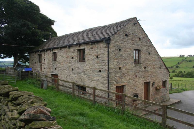
Barn to Thornset Fields
Farmhouse
SK 08 NW 4/100A
II GV
2.
C18 barn in coursed stone with stone slate roof and full-height carriage entry.
Listing NGR: SK0106488429
External links are from the relevant listing authority and, where applicable, Wikidata. Wikidata IDs may be related buildings as well as this specific building. If you want to add or update a link, you will need to do so by editing the Wikidata entry.


Other nearby listed buildings
