Approximate Location Map
Large Map »
Latitude: 51.1477 / 51°8'51"N
Longitude: -2.7155 / 2°42'55"W
OS Eastings: 350048
OS Northings: 138960
OS Grid: ST500389
Mapcode National: GBR MK.7XH9
Mapcode Global: VH8B3.WF90
Plus Code: 9C3V47XM+3R
Entry Name: 38 and 40, High Street
Listing Date: 15 March 1974
Grade: II
Source: Historic England
Source ID: 1057934
English Heritage Legacy ID: 265947
ID on this website: 101057934
Location: Glastonbury, Somerset, BA6
County: Somerset
District: Mendip
Civil Parish: Glastonbury
Built-Up Area: Glastonbury
Traditional County: Somerset
Lieutenancy Area (Ceremonial County): Somerset
Tagged with: Building
This list entry was subject to a Minor Amendment on 08/11/2012
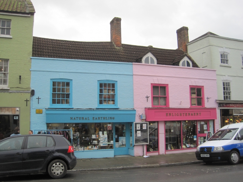
ST 5038 8/56
1133
HIGH STREET
(South Side)
Nos 38 and 40
GV
II
Probably early C18, with later detail. One building with two 2-storey 2-window
brick fronts (painted). Parapet. Pantile roof. Two C19 dormers with bargeboards
and finials, casements with semi-circular heads. Sashes with keystones in moulded
reveals to main front. Glazing bars to No 40 only. Modern shop-fronts.
Flats 1, 2 and 3 King Arthurs Court and nos. 38 to 42 (even) High Street form a group.
Listing NGR: ST5005038960
External links are from the relevant listing authority and, where applicable, Wikidata. Wikidata IDs may be related buildings as well as this specific building. If you want to add or update a link, you will need to do so by editing the Wikidata entry.


Other nearby listed buildings
