Approximate Location Map
Large Map »
Latitude: 51.1881 / 51°11'17"N
Longitude: -2.4761 / 2°28'33"W
OS Eastings: 366824
OS Northings: 143317
OS Grid: ST668433
Mapcode National: GBR MW.5JHJ
Mapcode Global: VH8B2.1DCJ
Plus Code: 9C3V5GQF+6H
Entry Name: Monument to Humphrey Parfitt in Churchyard, 2 Metres West of Churchyard Cross, Church of St Bartholomew
Listing Date: 25 February 1988
Grade: II
Source: Historic England
Source ID: 1058530
English Heritage Legacy ID: 268261
ID on this website: 101058530
Location: Cranmore, Somerset, BA4
County: Somerset
District: Mendip
Civil Parish: Cranmore
Traditional County: Somerset
Lieutenancy Area (Ceremonial County): Somerset
Tagged with: Monument
CRANMORE CP COOK'S LANE (West side)
ST64SE
WEST CRANMORE
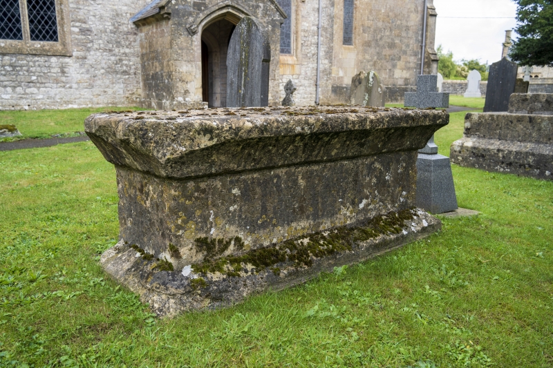
4/61 Monument to Humpfrey Parfitt in
churchyard, 2m west of Churchyard
- Cross, Church of St Bartholomew
GV
II
Chest tomb. 1674 to Humphrey Parfitt. Dressed stone. Chamfered plinth, rectangular chest, cavetto-moulded slab top.
Listing NGR: ST6682443317
External links are from the relevant listing authority and, where applicable, Wikidata. Wikidata IDs may be related buildings as well as this specific building. If you want to add or update a link, you will need to do so by editing the Wikidata entry.


Other nearby listed buildings
