Approximate Location Map
Large Map »
Latitude: 51.5728 / 51°34'22"N
Longitude: -1.2036 / 1°12'12"W
OS Eastings: 455289
OS Northings: 186290
OS Grid: SU552862
Mapcode National: GBR 91B.8J6
Mapcode Global: VHCYN.3Q1P
Plus Code: 9C3WHQFW+4H
Entry Name: 10 and 11, Thorpe Street
Listing Date: 13 January 1986
Grade: II
Source: Historic England
Source ID: 1059277
English Heritage Legacy ID: 247937
ID on this website: 101059277
Location: Aston Upthorpe, South Oxfordshire, OX11
County: Oxfordshire
District: South Oxfordshire
Civil Parish: Aston Upthorpe
Built-Up Area: Aston Tirrold
Traditional County: Berkshire
Lieutenancy Area (Ceremonial County): Oxfordshire
Church of England Parish: Aston Tirrold
Church of England Diocese: Oxford
Tagged with: Building
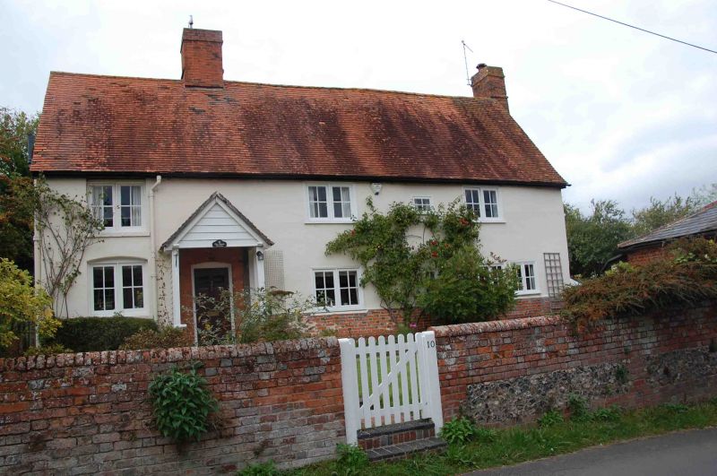
ASTON UPTHORPE THORPE STREET
SU5586 (West side)
7/53 Nos. 10 and 11
GV II
House, formerly converted to 2 houses. Late C17. Brick base; render, probably on
timber framing; recent plain-tile roof; brick ridge stack to left of centre, end
stack to right. 3-unit lobby entry plan. 2-storey, 4-window range. 6-panel
part-glazed door to left of centre with open C19 timber framed porch with gabled
roof. Irregular fenestration of mostly 2-light wood casements. Noted as having
extensive beaming to the interior.
Listing NGR: SU5528986290
External links are from the relevant listing authority and, where applicable, Wikidata. Wikidata IDs may be related buildings as well as this specific building. If you want to add or update a link, you will need to do so by editing the Wikidata entry.


Other nearby listed buildings
