Latitude: 51.4863 / 51°29'10"N
Longitude: -1.0357 / 1°2'8"W
OS Eastings: 467053
OS Northings: 176814
OS Grid: SU670768
Mapcode National: GBR Q42.JM
Mapcode Global: VHDWL.0WBZ
Plus Code: 9C3WFXP7+GP
Entry Name: The Almshouse
Listing Date: 24 October 1951
Grade: II*
Source: Historic England
Source ID: 1059522
English Heritage Legacy ID: 247413
ID on this website: 101059522
Location: Mapledurham, South Oxfordshire, RG4
County: Oxfordshire
District: South Oxfordshire
Civil Parish: Mapledurham
Traditional County: Oxfordshire
Lieutenancy Area (Ceremonial County): Oxfordshire
Church of England Parish: Caversham Thameside and Mapledurham
Church of England Diocese: Oxford
Tagged with: Almshouse
MAPLEDURHAM THE STREET SU67NE (West side) 9/195 Nos. 1 and 2 The Almshouse 24/10/51
GV II*
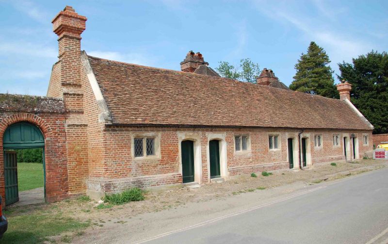
Almshouse, now two houses. Early C17 with C20 additions to rear. Red brick; plain tile roof; brick end stacks. Single storey; 6-window range. 2 plank doors to centre with 4-centre arch chamfered stone surrounds. Two 2-light moulded stone mullion leaded windows to left and right of centre. 2 plank doors to left and right of centre with 4-centre arch chamfered stone surrounds. 2-light moulded stone mullion leaded window to left and right. Interior not inspected. Archway to left. History: Built in 1629 under the terms of the will of Sir Charles Lister (d.1613) by his godson Lister Blount. (R.Williams: Mapledurham House Guide Book 1977).
Listing NGR: SU6705376814
External links are from the relevant listing authority and, where applicable, Wikidata. Wikidata IDs may be related buildings as well as this specific building. If you want to add or update a link, you will need to do so by editing the Wikidata entry.


Other nearby listed buildings