Latitude: 51.657 / 51°39'25"N
Longitude: -1.2106 / 1°12'38"W
OS Eastings: 454702
OS Northings: 195654
OS Grid: SU547956
Mapcode National: GBR 90C.0RD
Mapcode Global: VHCY7.YMV2
Plus Code: 9C3WMQ4Q+RQ
Entry Name: The Plough Public House
Listing Date: 16 March 1987
Grade: II
Source: Historic England
Source ID: 1059816
English Heritage Legacy ID: 248788
Also known as: Plough Inn
Plough Inn, Abingdon
ID on this website: 101059816
Location: Clifton Hampden, South Oxfordshire, OX14
County: Oxfordshire
District: South Oxfordshire
Civil Parish: Clifton Hampden
Built-Up Area: Clifton Hampden
Traditional County: Oxfordshire
Lieutenancy Area (Ceremonial County): Oxfordshire
Church of England Parish: Clifton Hampden
Church of England Diocese: Oxford
Tagged with: Pub Thatched pub
CLIFTON HAHPDEN ABINGDON ROAD SU5495 (North side) 11/3 The Plough Inn Public House
- II
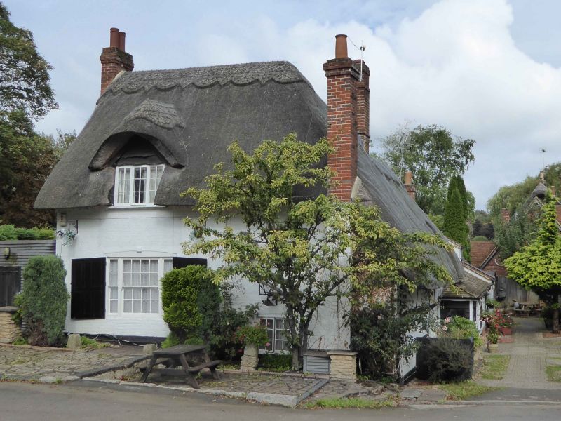
Public house. C17 with late C18 additions to rear. Large timber framing with painted brick infill to ground floor; render above, probably on timber framing; thatch roof; brick ridge stack to centre. Single storey and attic; 2-window range. 2 plank doors to right under C20 timber framed porch. 4-light casement to right of centre, 12-pane window to left. Swept dormer to right. Late C18 addition to rear left. Painted brick; thatch roof. Single storey and attic, at different level. Tripartite unhorned sash with glazing bars and segmental brick head, having keystone. Gabled dormer. Chamfered spine beam to ground floor centre.
Listing NGR: SU5470295654
External links are from the relevant listing authority and, where applicable, Wikidata. Wikidata IDs may be related buildings as well as this specific building. If you want to add or update a link, you will need to do so by editing the Wikidata entry.


Other nearby listed buildings