Latitude: 51.0285 / 51°1'42"N
Longitude: -2.9466 / 2°56'47"W
OS Eastings: 333709
OS Northings: 125885
OS Grid: ST337258
Mapcode National: GBR M7.HK9D
Mapcode Global: FRA 46QD.FVS
Plus Code: 9C3V23H3+98
Entry Name: Higher Huntham Farmhouse
Listing Date: 25 February 1955
Grade: II
Source: Historic England
Source ID: 1060415
English Heritage Legacy ID: 270835
ID on this website: 101060415
Location: Huntham, Somerset, TA3
County: Somerset
District: Somerset West and Taunton
Civil Parish: North Curry
Traditional County: Somerset
Lieutenancy Area (Ceremonial County): Somerset
Tagged with: Farmhouse Thatched farmhouse
NORTH CURRY CP ST3325 HUNTHAM
2/51 Higher Huntham Farmhouse
25.2.55
GV II
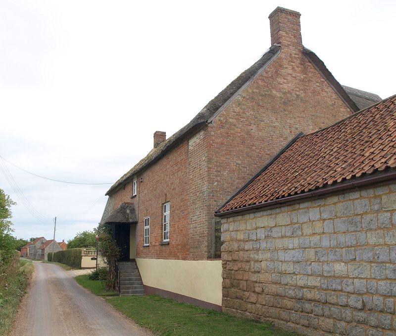
Farmhouse. C16, altered early C18, probably converted temporarily to 2 dwellings late C19, partly refenestrated mid C20. Rubble and possibly cob faced on north front with brick and blue lias random rubble, roughcast south wings flanking squared and coursed blue lias centre, Ham stone dressings on south front, thatched roof, coped verges to wings, brick stacks gable ends, random rubble green concrete tiled lean-to addition on east front, continued with steeply pitched pantile roofed wing with tall brick stack in gable end. U-plan: 3-cell and cross passage alterd internally with corridor addition and resited entrance, symmetrical wings on south front, ground drops away on north front facing road, long lean-to addition with extension on east side. South front: 2 storeys, 1:4:1 bays; 2-light hollow chamfer stone mullioned windows left gable end under hoodmould and centre, right gable end hoodmould only, ground floor left gable end unlit but with similar window in re-entrant angle, centre all openings under brick lintels, C20 windows, entrances second bay left and in re-entrant angle of right hand wing, unlit on gable end. Interior: large chamfered bressumer to east gable end, possibly smoke bay with inserted dogleg stair in north east corner, exposed chamfered curved truss, corbelled out to carry chamfered beam, steeply chamfered beams with scroll stops at west end, a lot of C18 joinery surviving. Upper storey not seen.
Listing NGR: ST3370925885
External links are from the relevant listing authority and, where applicable, Wikidata. Wikidata IDs may be related buildings as well as this specific building. If you want to add or update a link, you will need to do so by editing the Wikidata entry.


Other nearby listed buildings