Approximate Location Map
Large Map »
Latitude: 51.2288 / 51°13'43"N
Longitude: 0.5466 / 0°32'47"E
OS Eastings: 577900
OS Northings: 150816
OS Grid: TQ779508
Mapcode National: GBR PRN.T5V
Mapcode Global: VHJMM.FC9V
Plus Code: 9F326GHW+GJ
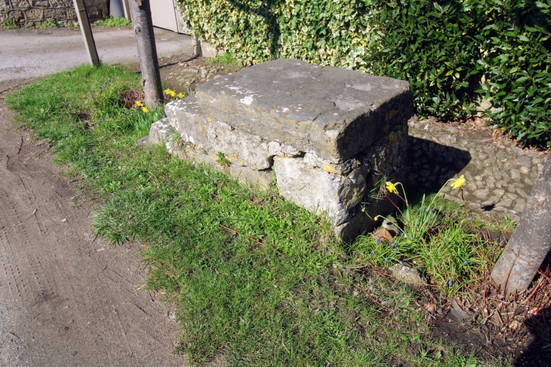
Entry Name: Mounting Block About 5 Metres South West of Tilts House
Listing Date: 25 March 1987
Grade: II
Source: Historic England
Source ID: 1060762
English Heritage Legacy ID: 174493
ID on this website: 101060762
Location: Cock Street, Maidstone, Kent, ME17
County: Kent
District: Maidstone
Civil Parish: Boughton Monchelsea
Traditional County: Kent
Lieutenancy Area (Ceremonial County): Kent
Tagged with: Building
BOUGHTON MONCHELSEA HEATH ROAD
TQ 75 SE (North side)
Cock Street
1/32 Mounting block
about 5 metres south-
west of Tilts House
GV II
Mounting block. C19 or earlier. Stone, with 4 steps running up from west to
east.
Listing NGR: TQ7790050816
External links are from the relevant listing authority and, where applicable, Wikidata. Wikidata IDs may be related buildings as well as this specific building. If you want to add or update a link, you will need to do so by editing the Wikidata entry.


Other nearby listed buildings
