Latitude: 51.4088 / 51°24'31"N
Longitude: 0.0724 / 0°4'20"E
OS Eastings: 544230
OS Northings: 169794
OS Grid: TQ442697
Mapcode National: GBR NP.YR6
Mapcode Global: VHHNY.6VMC
Plus Code: 9F32C35C+GX
Entry Name: The Ivy House
Listing Date: 29 June 1973
Grade: II
Source: Historic England
Source ID: 1064399
English Heritage Legacy ID: 358531
ID on this website: 101064399
Location: Bromley, London, BR7
County: London
District: Bromley
Electoral Ward/Division: Chislehurst
Parish: Non Civil Parish
Built-Up Area: Bromley
Traditional County: Kent
Lieutenancy Area (Ceremonial County): Greater London
Church of England Parish: Chislehurst St Nicholas
Church of England Diocese: Rochester
Tagged with: House
MORLEY ROAD, CHISLEHURST 1. 4407 The Ivy House TQ 46 NW 5/77 II
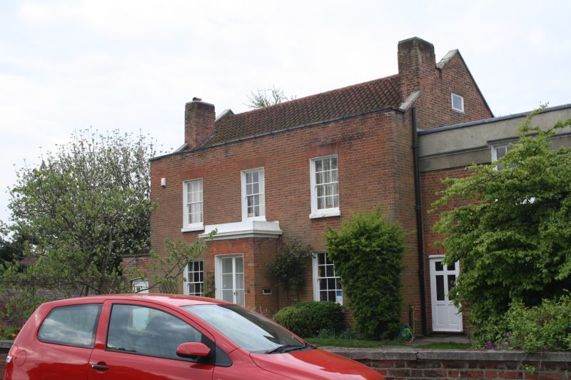
2. Built in 1810. Originally 3 storeys but the top storey has recently been removed after bomb damage. 3 windows. Red brick. Pantile roof. Glazing bars intact. Modern porch enclosing doorway with semi-circular fanlight.
Listing NGR: TQ4423069794
External links are from the relevant listing authority and, where applicable, Wikidata. Wikidata IDs may be related buildings as well as this specific building. If you want to add or update a link, you will need to do so by editing the Wikidata entry.


Other nearby listed buildings