Latitude: 51.4756 / 51°28'32"N
Longitude: -0.1236 / 0°7'24"W
OS Eastings: 530412
OS Northings: 176848
OS Grid: TQ304768
Mapcode National: GBR JT.F6
Mapcode Global: VHGR5.T51N
Plus Code: 9C3XFVGG+6H
Entry Name: Stockwell Baptist Church
Listing Date: 17 July 1970
Grade: II
Source: Historic England
Source ID: 1064950
English Heritage Legacy ID: 204634
ID on this website: 101064950
Location: South Lambeth, Lambeth, London, SW8
County: London
District: Lambeth
Electoral Ward/Division: Stockwell
Parish: Non Civil Parish
Built-Up Area: Lambeth
Traditional County: Surrey
Lieutenancy Area (Ceremonial County): Greater London
Church of England Parish: South Lambeth St Anne and All Saints
Church of England Diocese: Southwark
Tagged with: Protestant church building
SOUTH LAMBETH ROAD SW8 1. (west side) 5023 Stockwell Baptist Church TQ 3076 12/857 17.7.70
II
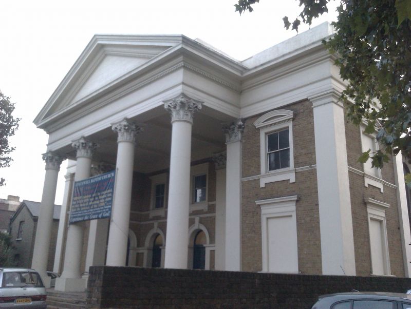
2. Imposing mid C19 building with two storey, five bay front to road. Three central bays in tetrastyle Corinthian pedimented portico, half in antis. Flat pilasters to side bays and entablature with blocking course. Five round arched ground floor openings with keys and impost string (two on inner porch returns). Moulded architraves to upper windows, square headed in outer bays with segmental pediments. Seven bay returns have round arched upper and segment arched lower windows in full height round arched recesses. Greyish brick with stone dressings.
Listing NGR: TQ3041276848
External links are from the relevant listing authority and, where applicable, Wikidata. Wikidata IDs may be related buildings as well as this specific building. If you want to add or update a link, you will need to do so by editing the Wikidata entry.


Other nearby listed buildings