Latitude: 53.8289 / 53°49'44"N
Longitude: -1.3946 / 1°23'40"W
OS Eastings: 439945
OS Northings: 437131
OS Grid: SE399371
Mapcode National: GBR LSP5.W5
Mapcode Global: WHDBL.K140
Plus Code: 9C5WRJH4+H5
Entry Name: Lime Trees Farmhouse
Listing Date: 22 July 1986
Grade: II
Source: Historic England
Source ID: 1065981
English Heritage Legacy ID: 422509
ID on this website: 101065981
Location: Barwick in Elmet, Leeds, West Yorkshire, LS15
County: Leeds
Civil Parish: Barwick in Elmet and Scholes
Built-Up Area: Barwick in Elmet
Traditional County: Yorkshire
Lieutenancy Area (Ceremonial County): West Yorkshire
Church of England Parish: Barwick
Church of England Diocese: Leeds
Tagged with: Farmhouse
BARWICK IN ELMET AND SCHOLES MAIN STREET SE3937 LS15 (west side), Barwick
17/25 No 72 (Lime Trees Farmhouse)
GV II
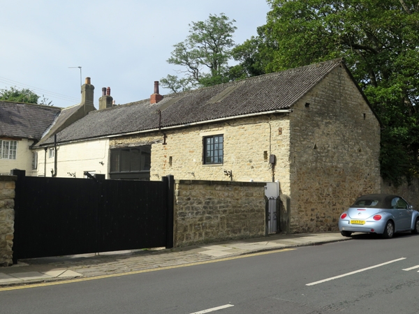
House and attached barn. Mid-late C18. Coursed rubble, partly rendered, Welsh blue-slate roof. L-shaped. 2-cell house with central lobby-entry plan. 2 storeys. Central doorway with wooden surround. To left end, single bay of 20-pane sash windows with monolithic lintels, projecting sills and flush-wood architraves. To right end, small pane Yorkshire sash window to each floor. Gable stack to left, central ridge stack (3 flues). Attached to right, short gabled wing with ridge stack, to which is attached barn partly converted to domestic use and of lesser interest. Rear: central doorway with to either side 16-pane sash window to each floor; ground-floor windows have wedge-shaped lintels. To right end, low outshut with lean-to roof probably partly-sunk cellar.
Interior: door entries, front and back, open against wide stack. No other features of interest.
Listing NGR: SE3994537131
External links are from the relevant listing authority and, where applicable, Wikidata. Wikidata IDs may be related buildings as well as this specific building. If you want to add or update a link, you will need to do so by editing the Wikidata entry.


Other nearby listed buildings