Latitude: 51.5168 / 51°31'0"N
Longitude: -0.1475 / 0°8'50"W
OS Eastings: 528637
OS Northings: 181390
OS Grid: TQ286813
Mapcode National: GBR CB.2F
Mapcode Global: VHGQZ.D4DK
Plus Code: 9C3XGV83+P2
Entry Name: 24, WIGMORE STREET W1 (See details for further address information)
Listing Date: 14 March 1966
Grade: II
Source: Historic England
Source ID: 1066073
English Heritage Legacy ID: 207628
ID on this website: 101066073
Location: Marylebone, Westminster, London, W1G
County: London
District: City of Westminster
Electoral Ward/Division: Marylebone High Street
Parish: Non Civil Parish
Built-Up Area: City of Westminster
Traditional County: Middlesex
Lieutenancy Area (Ceremonial County): Greater London
Church of England Parish: All Souls Langham Place
Church of England Diocese: London
Tagged with: Building
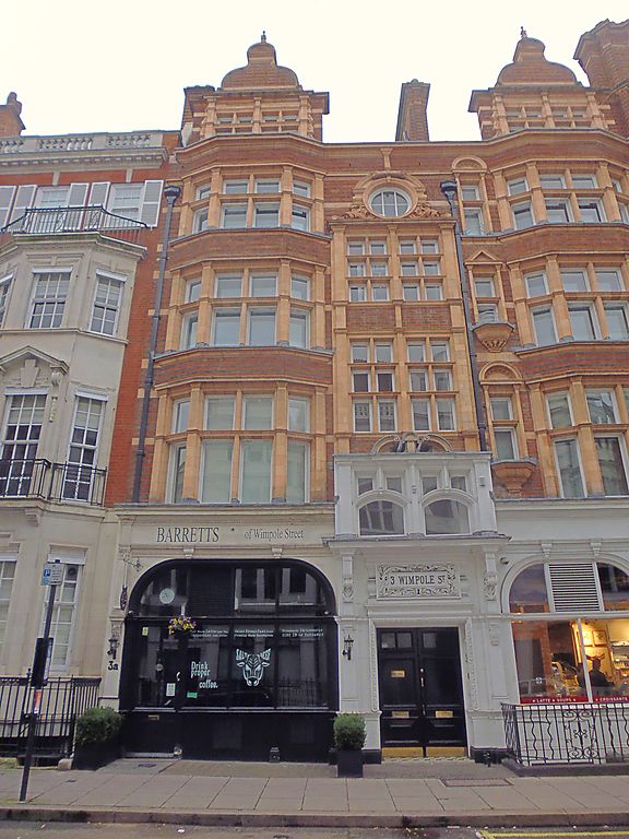
TQ 2881 SE CITY OF WESTMINSTER WIGMORE STREET W1 56/49 (north side) No 24 (including 14.3.66 3 Wimpole Street) GV II Shops and flats above. Dated 1893 by C H Worley. Red and blue banded brick and terracotta dressings, tiled roof, in a free Jacobethan style on corner site. Five storeys including attic. Ground floor shop fronts terracotta faced with arcaded windows and short pilasters above impost level rising to dentilled fascia, splayed corner entrance. Main feature of elevation is the large bowed corbelled oriel-tower with mullioned lights rising through to third floor and finished with parapet, above which is a set back tile hung fourth floor with tiled conical roof surmounted by a delicate cupola. The corner bay is separated from Wimpole Street front by a boldly projecting and modelled external chimney stack. Two full height canted bays with shaped finialed gables to this front with 4 mullioned and transomed lights to each floor with a bay of heavy fenestration at mezzanine level and segmental arched entrance to flats between. Sill courses and band courses at transom levels. Prominant corner site and part of the marked brick and terracotta idiom of this part of Wigmore Street.
Listing NGR: TQ2863781394
External links are from the relevant listing authority and, where applicable, Wikidata. Wikidata IDs may be related buildings as well as this specific building. If you want to add or update a link, you will need to do so by editing the Wikidata entry.


Other nearby listed buildings