Latitude: 51.5166 / 51°30'59"N
Longitude: -0.1484 / 0°8'54"W
OS Eastings: 528572
OS Northings: 181368
OS Grid: TQ285813
Mapcode National: GBR BB.VH
Mapcode Global: VHGQZ.C4XP
Plus Code: 9C3XGV82+JJ
Entry Name: 42, Wigmore Street W1
Listing Date: 5 February 1970
Grade: II
Source: Historic England
Source ID: 1066075
English Heritage Legacy ID: 207631
ID on this website: 101066075
Location: Marylebone, Westminster, London, W1U
County: London
District: City of Westminster
Electoral Ward/Division: Marylebone High Street
Parish: Non Civil Parish
Built-Up Area: City of Westminster
Traditional County: Middlesex
Lieutenancy Area (Ceremonial County): Greater London
Church of England Parish: All Souls Langham Place
Church of England Diocese: London
Tagged with: Building
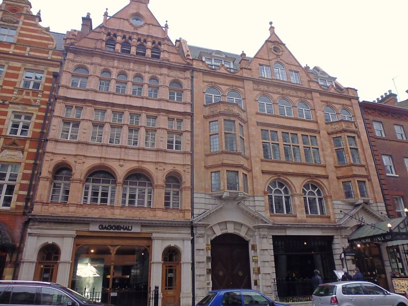
TQ 2881 SE CITY OF WESTMINSTER WIGMORE STREET Wl 56/45 (north side) 5.2.70 No 42 G.V. II Shop, showroom and flats. 1890S. Pale terracotta, tiled roof. Flemish Renaissance style. Five storeys. Three main bays. Mid C20 shop front across ground floor. First floor has arched windows to outer bays and a pair of arcaded windows to centre. Second floor has similar arrangement but with flat arched mullioned windows. Third floor has similar arched outer windows and group of 4 arcaded mullioned lights to centre. Fourth floor in gable has group of 4 semicircular arched lights with miniature pairs of arcaded top lights; oculus in apex - all windows small paned casements. Moulded sill and string courses to each floor, carved panels to frieze below fourth floor. The gable rises from carved stops, has finials crowning shafts rising from fourth floor window and is surmounted by segmental pediment cap. Tall corniced terracotta chimney stack to west gable end.
Listing NGR: TQ2856681372
External links are from the relevant listing authority and, where applicable, Wikidata. Wikidata IDs may be related buildings as well as this specific building. If you want to add or update a link, you will need to do so by editing the Wikidata entry.


Other nearby listed buildings