Latitude: 51.5187 / 51°31'7"N
Longitude: -0.1618 / 0°9'42"W
OS Eastings: 527640
OS Northings: 181576
OS Grid: TQ276815
Mapcode National: GBR 79.VR
Mapcode Global: VHGQZ.43V3
Plus Code: 9C3XGR9Q+F7
Entry Name: 25, 25A and 26, Bryanston Square W1
Listing Date: 10 September 1954
Last Amended: 1 December 1987
Grade: II
Source: Historic England
Source ID: 1066353
English Heritage Legacy ID: 208880
ID on this website: 101066353
Location: Lisson Grove, Westminster, London, W1H
County: London
District: City of Westminster
Electoral Ward/Division: Bryanston and Dorset Square
Parish: Non Civil Parish
Built-Up Area: City of Westminster
Traditional County: Middlesex
Lieutenancy Area (Ceremonial County): Greater London
Church of England Parish: St Mary Bryanston Square
Church of England Diocese: London
Tagged with: Building
TQ 2781 NE CITY OF WESTMINSTER BRYANSTON SQUARE, W1 43/96 (North side) 10.9.54 (Nos 25 and 26) Nos. 25, 25A and 26. 9.1.70 (No 25A only) G.V. II
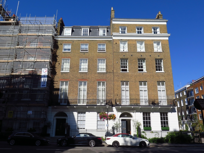
Terraced town houses on north side of square. 1811 by Joseph Parkinson for the Portman Estate. Brown brick with banded stucco rustication to ground floor; concealed slate roofs. 5 storeys and basement. Each front 3 windows wide; No. 26 with full height canted bay. Semicircular arched doorways to left with panelled doors and fanlights. Recessed sashes, some with glazing bars, under flat gauged red brick arches to upper floors. Plat bands over ground floors and. crowning stucco cornice and blocking course. No. 25 has dentilled entablature over 3rd floor and has a 5 bay return with geometric patterned, cast iron balcony to 1st floor. Cast iron area railings with urn finials.
Georgian London; John Summerson.
Listing NGR: TQ2764081576
External links are from the relevant listing authority and, where applicable, Wikidata. Wikidata IDs may be related buildings as well as this specific building. If you want to add or update a link, you will need to do so by editing the Wikidata entry.


Other nearby listed buildings