Latitude: 51.1259 / 51°7'33"N
Longitude: 0.2581 / 0°15'28"E
OS Eastings: 558109
OS Northings: 138714
OS Grid: TQ581387
Mapcode National: GBR MPZ.631
Mapcode Global: VHHQD.FY8S
Plus Code: 9F3247G5+96
Entry Name: 45 and 47, the Pantiles
Listing Date: 20 May 1952
Grade: II
Source: Historic England
Source ID: 1066573
English Heritage Legacy ID: 168131
ID on this website: 101066573
Location: Royal Tunbridge Wells, Tunbridge Wells, Kent, TN2
County: Kent
District: Tunbridge Wells
Electoral Ward/Division: Pantiles and St Mark's
Parish: Non Civil Parish
Built-Up Area: Royal Tunbridge Wells
Traditional County: Kent
Lieutenancy Area (Ceremonial County): Kent
Church of England Parish: Tunbridge Wells King Charles the Martyr
Church of England Diocese: Rochester
Tagged with: Building
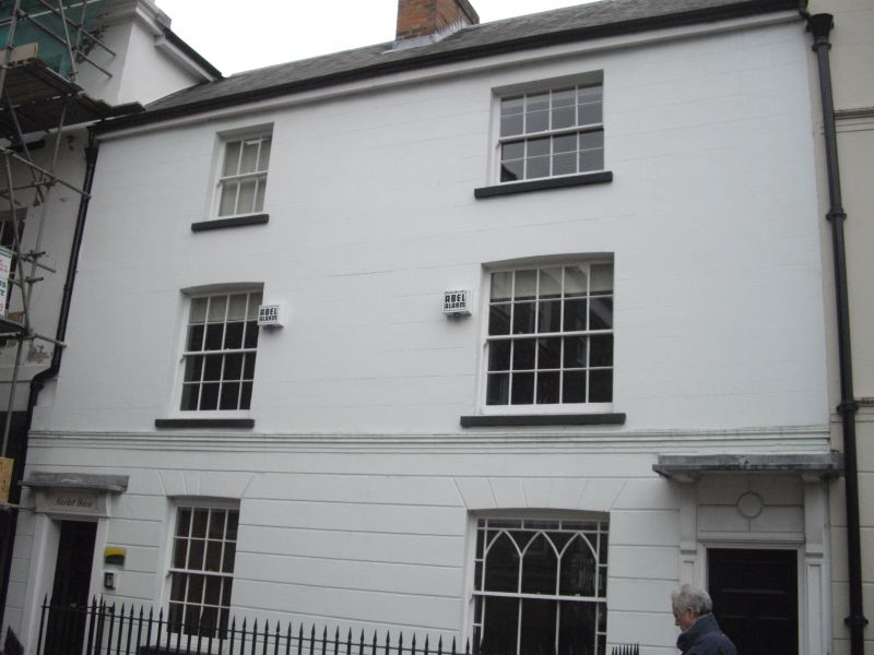
THE PANTILES
1.
1746
(South East Side)
Nos 45 and 47
TQ 5838 NW 1/293 20.5.52.
II GV
2.
Early Cl9. 3 storeys stuccoed. Eaves cornice. 2 windows with glazing bars
intact. Doorcases with pilasters, No 45 with a projecting cornice and No 47 a
rectangular fanlight and flat hood over on brackets. Cast iron spear railings
to forecourts.
Nos 45 to 61 (odd) form a group together with Nos 21 to 31a (odd).
Listing NGR: TQ5811338715
External links are from the relevant listing authority and, where applicable, Wikidata. Wikidata IDs may be related buildings as well as this specific building. If you want to add or update a link, you will need to do so by editing the Wikidata entry.


Other nearby listed buildings