Latitude: 51.5111 / 51°30'40"N
Longitude: -0.1416 / 0°8'29"W
OS Eastings: 529058
OS Northings: 180770
OS Grid: TQ290807
Mapcode National: GBR DD.CG
Mapcode Global: VHGQZ.H8HX
Plus Code: 9C3XGV65+F9
Entry Name: 4, Clifford Street W1
Listing Date: 9 January 1970
Grade: II
Source: Historic England
Source ID: 1066981
English Heritage Legacy ID: 209229
ID on this website: 101066981
Location: Mayfair, Westminster, London, W1S
County: London
District: City of Westminster
Electoral Ward/Division: West End
Parish: Non Civil Parish
Built-Up Area: City of Westminster
Traditional County: Middlesex
Lieutenancy Area (Ceremonial County): Greater London
Church of England Parish: St Anne Soho
Church of England Diocese: London
Tagged with: Building
TQ 2980 NW CITY OF WESTMINSTER CLIFFORD STREET W1 70/35 No 4 9.1.70 GV II
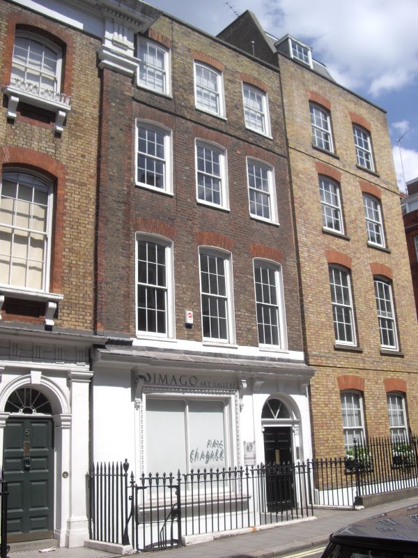
Terrace house, 1719 by John Witt. Brown brick, ground floor stuccoed and altered early C19, slate roof. 4 storeys and basement. 3 windows wide. Early C19 semicircular arched doorway to left with fanlight and enlarged ground floor window. Upper floors retain segmental arched windows, revealed sashes, glazing bars intact on 2nd and 3rd floors. Parapet with coping. Party wall giant pilaster surmounted by urn shared with No 5 q.v. Part of the development of the Burlington Estate. Interior retains panelled entrance hall with box cornice and staircase with lower flight having cut carved strings, turned balusters, columnar newels and moulded handrail, theupper flight similar but with closed string.
Survey of London; vol XXXII
Listing NGR: TQ2905780771
External links are from the relevant listing authority and, where applicable, Wikidata. Wikidata IDs may be related buildings as well as this specific building. If you want to add or update a link, you will need to do so by editing the Wikidata entry.


Other nearby listed buildings