Latitude: 53.4752 / 53°28'30"N
Longitude: -2.1506 / 2°9'2"W
OS Eastings: 390100
OS Northings: 397614
OS Grid: SJ901976
Mapcode National: GBR FXF7.6Z
Mapcode Global: WHB9H.YX27
Plus Code: 9C5VFRGX+3Q
Entry Name: Fairfield High School for Girls, East Block Only
Listing Date: 14 July 1987
Grade: II
Source: Historic England
Source ID: 1067586
English Heritage Legacy ID: 438582
ID on this website: 101067586
Location: Droylsden, Tameside, Greater Manchester, M43
County: Tameside
Electoral Ward/Division: Droylsden East
Parish: Non Civil Parish
Built-Up Area: Droylsden
Traditional County: Lancashire
Lieutenancy Area (Ceremonial County): Greater Manchester
Church of England Parish: Droylsden St Mary
Church of England Diocese: Manchester
Tagged with: Building
DROYLSDEN FAIRFIELD SQUARE SJ 99 NW
4/87 Fairfield High School for girls, East block only
G.V. II
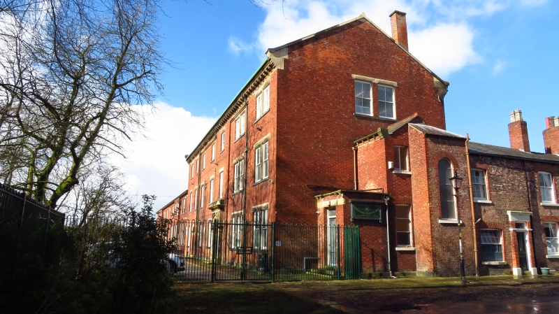
School, built as a boys boarding school. "AD 1871" on door surround. Flemish bond brick with slate roof and ashlar dressings. Total of 7 bays and 3 storeys with entrance porch against right gable-end. Projecting stone plinth, bracketed eaves gutter, coped gables with kneelers. Bays 1 and 2, 5 and 7 are slightly advanced. The door in bay 5 has a fanlight, enriched spandrels, a cornice and a blocking course. Smaller arched door in bay 2. Windows are single or paired 4-pane sashes with stone lintels and sills. Included for group value. The form and massing of the building make clear reference to the Moravian Bretheren's House which it replaced.
Listing NGR: SJ9010097614
External links are from the relevant listing authority and, where applicable, Wikidata. Wikidata IDs may be related buildings as well as this specific building. If you want to add or update a link, you will need to do so by editing the Wikidata entry.


Other nearby listed buildings