Latitude: 53.4994 / 53°29'57"N
Longitude: -2.1007 / 2°6'2"W
OS Eastings: 393414
OS Northings: 400305
OS Grid: SD934003
Mapcode National: GBR FWRZ.Z8
Mapcode Global: WHB9J.P9VM
Plus Code: 9C5VFVXX+QP
Entry Name: Wilshaw Dale Cottage Wilshaw Dale Farmhouse
Listing Date: 14 July 1987
Grade: II
Source: Historic England
Source ID: 1068004
English Heritage Legacy ID: 212690
ID on this website: 101068004
Location: Waterloo, Tameside, Greater Manchester, OL7
County: Tameside
Electoral Ward/Division: Ashton Waterloo
Parish: Non Civil Parish
Built-Up Area: Ashton-under-Lyne
Traditional County: Lancashire
Lieutenancy Area (Ceremonial County): Greater Manchester
Church of England Parish: Ashton-under-Lyne Christ Church
Church of England Diocese: Manchester
Tagged with: Farmhouse
ASHTON-UNDER-LYNE WILSHAW ROAD SD 90 SW (north side)
1/38 Wilshaw Dale Farmhouse and - Wilshaw Dale Cottage
- II
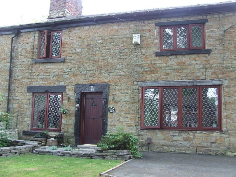
2 adjoining houses. "H 1812" on door lintel of Wilshaw Dale Cottage. Hammer-dressed stone with slate roof. Total of 3 bays and 2 storeys with later additions to rear of the Farmhouse which are not of special interest. The Cottage constitutes bays 2 and 3 which have a central 6-panel door with square-cut stone surround and dated lintel, 3 windows with stone lintels and sills and C20 casements and one bow window. Bay 1 (the Farmhouse) has a central gable entrance with ogee-arched head. Similarly, 3 of the 4 windows have ogee-arched heads all with fanciful leaded interlacing. The fourth is a C20 casement with stone lintel and sill. The front has another ogee-headed window (as above) in bay 1. Brick ridge chimney stacks.
Listing NGR: SD9341400305
External links are from the relevant listing authority and, where applicable, Wikidata. Wikidata IDs may be related buildings as well as this specific building. If you want to add or update a link, you will need to do so by editing the Wikidata entry.


Other nearby listed buildings