Approximate Location Map
Large Map »
Latitude: 51.3096 / 51°18'34"N
Longitude: 0.8711 / 0°52'15"E
OS Eastings: 600202
OS Northings: 160632
OS Grid: TR002606
Mapcode National: GBR RTR.YWF
Mapcode Global: VHKJW.1BVX
Plus Code: 9F328V5C+RC
Entry Name: Thatch Cottages
Listing Date: 3 August 1972
Last Amended: 12 January 2011
Grade: II
Source: Historic England
Source ID: 1069231
English Heritage Legacy ID: 176509
ID on this website: 101069231
Location: Ospringe, Swale, Kent, ME13
County: Kent
District: Swale
Civil Parish: Ospringe
Built-Up Area: Faversham
Traditional County: Kent
Lieutenancy Area (Ceremonial County): Kent
Tagged with: Cottage Thatched cottage
OSPRINGE
1446/2/103 WATER LANE
03-AUG-72 (West side)
1 AND 2
THATCH COTTAGES
(Formerly listed as:
WATER LANE
1 AND 2
THATCHED COTTAGES)
GV II
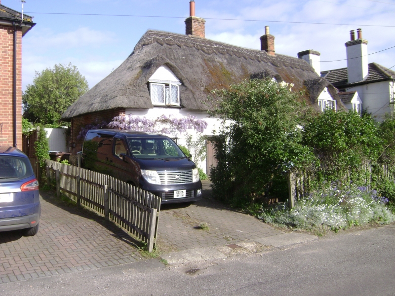
Pair of C16 cottages.
Timber framed and weather boarded cottages with thatched and slated roof. One storey and attic, with 3 gabled semi-dormers in hipped roof, and stacks to north and south ends. Four wooden casement windows, the central of 3 mullioned lights. Boarded door to centre left, and half glazed door to centre, with small fire-light over.
Miller's House, The Arbory and Nos 1 & 2 Thatch Cottage form a group.
HISTORY
The pair of cottages are shown on the 1879 Ordnance survey map but fabric and design would suggest that they date to the C16.
External links are from the relevant listing authority and, where applicable, Wikidata. Wikidata IDs may be related buildings as well as this specific building. If you want to add or update a link, you will need to do so by editing the Wikidata entry.


Other nearby listed buildings
