Approximate Location Map
Large Map »
Latitude: 51.1968 / 51°11'48"N
Longitude: 0.2755 / 0°16'31"E
OS Eastings: 559088
OS Northings: 146640
OS Grid: TQ590466
Mapcode National: GBR MP0.Y74
Mapcode Global: VHHQ6.Q5JV
Plus Code: 9F3257WG+P6
Entry Name: The Rose and Crown Hotel
Listing Date: 8 May 1950
Grade: II
Source: Historic England
Source ID: 1069974
English Heritage Legacy ID: 178680
ID on this website: 101069974
Location: Tonbridge, Tonbridge and Malling, Kent, TN9
County: Kent
District: Tonbridge and Malling
Electoral Ward/Division: Medway
Parish: Non Civil Parish
Built-Up Area: Tonbridge
Traditional County: Kent
Lieutenancy Area (Ceremonial County): Kent
Church of England Parish: Tonbridge St Peter and St Paul
Church of England Diocese: Rochester
Tagged with: Pub
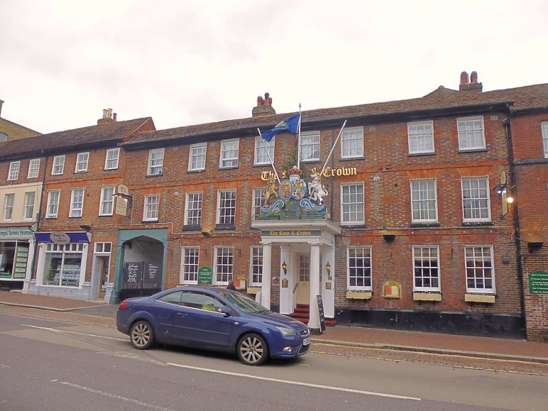
1. HIGH STREET
1732 (East Side)
The Rose and Crown Hotel
TQ 594 NW 3/8 8.5.50.
II GV
2.
C18 facade but a timber-framed building beneath this. 3 storeys. 8 windows.
Red brick and grey headers. Brick stringcourses above ground and first
floors, Moulded wooden eaves cornice. Tiled roof. Glazing bars intact.
Porch projecting almost the whole width of the pavement with Doric columns
and wide projectingcornice surmounted by 2 shields with the lion and
unicorn supporters and the crown above. Obtusely pointed carriage archway
beneath the northernmost window bay.
Nos 123, 125, The Rose and Crown Hotel, and Nos 127, 129, and 131 together
form a group
Listing NGR: TQ5911346639
External links are from the relevant listing authority and, where applicable, Wikidata. Wikidata IDs may be related buildings as well as this specific building. If you want to add or update a link, you will need to do so by editing the Wikidata entry.


Other nearby listed buildings
