Latitude: 53.4037 / 53°24'13"N
Longitude: -2.9741 / 2°58'26"W
OS Eastings: 335336
OS Northings: 390098
OS Grid: SJ353900
Mapcode National: GBR 76P.NV
Mapcode Global: WH877.9Q00
Plus Code: 9C5VC23G+F9
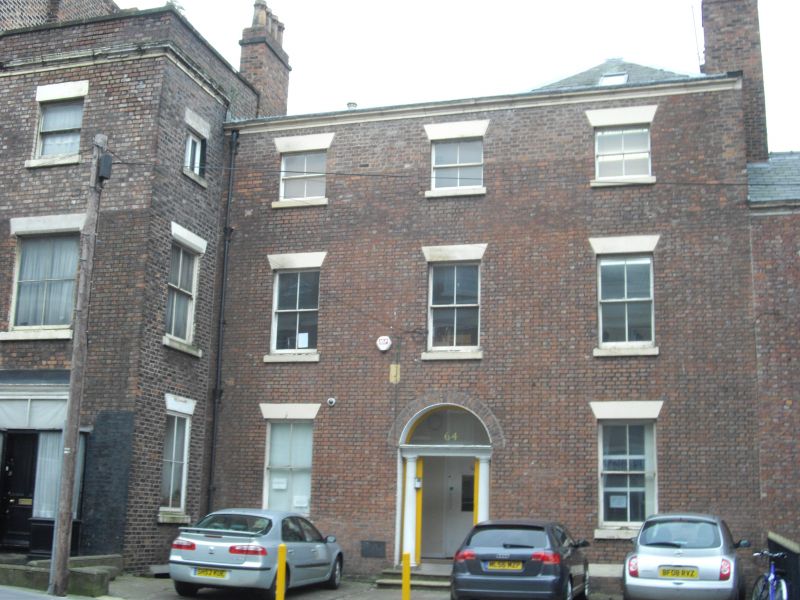
Entry Name: 64, Mount Pleasant
Listing Date: 14 March 1975
Last Amended: 19 June 1985
Grade: II
Source: Historic England
Source ID: 1070610
English Heritage Legacy ID: 359127
ID on this website: 101070610
Location: Liverpool, Merseyside, L3
County: Liverpool
Electoral Ward/Division: Central
Parish: Non Civil Parish
Built-Up Area: Liverpool
Traditional County: Lancashire
Lieutenancy Area (Ceremonial County): Merseyside
Church of England Parish: St Luke in the City Team
Church of England Diocese: Liverpool
Tagged with: Building
SJ 3590 SW MOUNT PLEASANT
(south side)
L3
54/786 No. 64
14.3.75. (formerly listed
with No. 62)
G.V. II
House. Late C18. Brick and stone dressings, slate roof. 3
storeys, 3 bays. All windows have wedge lintels and are
sashed. Round-headed central entrance with Doric doorcase
and 6-panelled door. Top cornice.
Listing NGR: SJ3533690098
External links are from the relevant listing authority and, where applicable, Wikidata. Wikidata IDs may be related buildings as well as this specific building. If you want to add or update a link, you will need to do so by editing the Wikidata entry.


Other nearby listed buildings