Approximate Location Map
Large Map »
Latitude: 51.0539 / 51°3'13"N
Longitude: 0.6295 / 0°37'46"E
OS Eastings: 584386
OS Northings: 131572
OS Grid: TQ843315
Mapcode National: GBR QW6.XMT
Mapcode Global: FRA D66B.H2Q
Plus Code: 9F323J3H+HR
Entry Name: East House
Listing Date: 16 August 1962
Grade: II
Source: Historic England
Source ID: 1070924
English Heritage Legacy ID: 180346
ID on this website: 101070924
Location: Rolvenden, Ashford, Kent, TN17
County: Kent
District: Ashford
Civil Parish: Rolvenden
Built-Up Area: Rolvenden
Traditional County: Kent
Lieutenancy Area (Ceremonial County): Kent
Tagged with: House
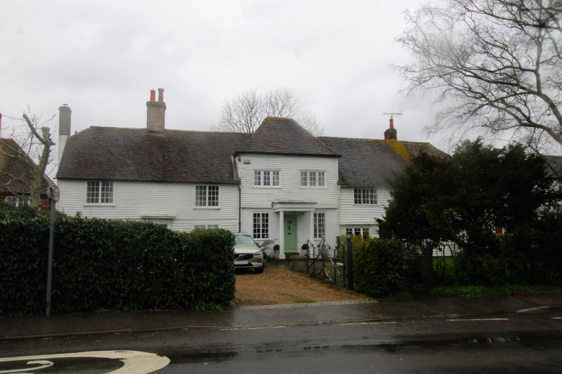
ROLVENDEN HIGH STREET
1.
5272 (west side)
No 66 to 70 (even)
No 72 and 74 (East House)
TQ 8431 18/302 16.8.62.
II GV
2.
An C18 range originally consisting of 3 houses now sub-divided. Two storeys,
6 windows in all. Nos 66-70 are faced with weatherboarding on the ground
floor and tile hung above - both painted. Nos 72 and 74 Project slightly
and have a higher elevation. Half-hipped roofs to Nos 66 and 74.
Listing NGR: TQ8438531576
External links are from the relevant listing authority and, where applicable, Wikidata. Wikidata IDs may be related buildings as well as this specific building. If you want to add or update a link, you will need to do so by editing the Wikidata entry.


Other nearby listed buildings
