Latitude: 53.9339 / 53°56'1"N
Longitude: -2.7608 / 2°45'39"W
OS Eastings: 350144
OS Northings: 448908
OS Grid: SD501489
Mapcode National: GBR 9Q5Y.2K
Mapcode Global: WH84T.KDJ2
Plus Code: 9C5VW6MQ+HM
Entry Name: Primrose Cottage
Listing Date: 17 April 1967
Grade: II
Source: Historic England
Source ID: 1072848
English Heritage Legacy ID: 185566
ID on this website: 101072848
Location: Scorton, Wyre, Lancashire, PR3
County: Lancashire
District: Wyre
Civil Parish: Nether Wyresdale
Traditional County: Lancashire
Lieutenancy Area (Ceremonial County): Lancashire
Church of England Parish: Barnacre All Saints
Church of England Diocese: Blackburn
Tagged with: Building
This list entry was subject to a Minor Amendment on 12 July 2024 to amend the name, address and reformat the text to current standards
SD 54 NW
5/172
NETHER WYRESDALE
scorton
STATION LANE
No 3 (Primrose Cottage)
(Formerly listed as No.3 (Inglenook))
17-4-1967
GV
II
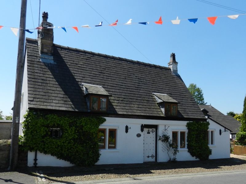
House, C17. Rendered rubble with steep corrugated iron roof. One storey with attic. To each side of the door there is a modern window with glazing bars. At the left there is a fire window with plain reveals, of three lights with timber mullions. The attic is lit by two dormers. The door has plain reveals. Gable chimneys, the left-hand one replacing a firehood and set inside the gable wall. The left-hand gable wall has, on both floors, a window with rebated and chamfered surround, hood, and central mullion removed. Inside, there is one cruck truss visible on the ground floor. Between the cruck blades there is a timber-framed wall which divided the housepart from the two rooms at the north-west end of the house. The adjacent chamfered doorways to these rooms remain, although one of the flat doorheads has been removed. In the housepart a heck post runs from floor to ceiling; a firehood bressumer has been sawn off below ceiling level. A second vertical timber is embedded in the front wall, also mortised for a bressumer. Built into the left-hand side wall of the present fireplace there is a fragment of dressed sandstone with a rope moulded edge, possibly part of a medieval grave cover.
Listing NGR: SD5014448908
External links are from the relevant listing authority and, where applicable, Wikidata. Wikidata IDs may be related buildings as well as this specific building. If you want to add or update a link, you will need to do so by editing the Wikidata entry.


Other nearby listed buildings