Latitude: 53.9326 / 53°55'57"N
Longitude: -2.7599 / 2°45'35"W
OS Eastings: 350201
OS Northings: 448768
OS Grid: SD502487
Mapcode National: GBR 9Q5Z.80
Mapcode Global: WH84T.KFY0
Plus Code: 9C5VW6MR+32
Entry Name: The Haven
Listing Date: 9 January 1986
Grade: II
Source: Historic England
Source ID: 1163983
English Heritage Legacy ID: 185565
ID on this website: 101163983
Location: Scorton, Wyre, Lancashire, PR3
County: Lancashire
District: Wyre
Civil Parish: Nether Wyresdale
Traditional County: Lancashire
Lieutenancy Area (Ceremonial County): Lancashire
Church of England Parish: Barnacre All Saints
Church of England Diocese: Blackburn
Tagged with: Architectural structure
NETHER WYRESDALE THE SQUARE SD 54 NW 5/171 Scorton - No.29 (The Haven) GV II
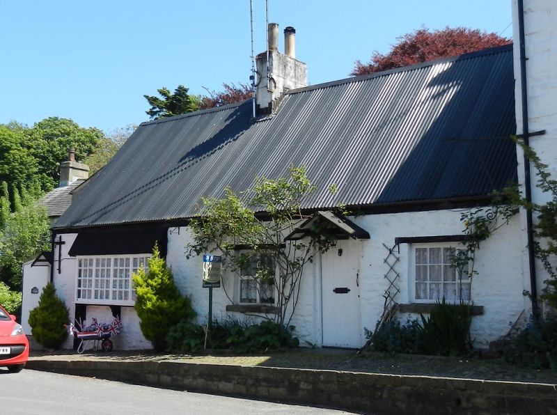
House, probably C17, altered. Slobbered rubble probably replacing clay and wattle, with corrugated iron roof over thatch. One storey with attic. At the left there is a wide early C20 window projecting under a canopy, It has casements with glazing bars and was added when the house was used as a shop. Further right are 2 windows with plain reveals, the left-hand one modern, the right-hand one with glazing bars. Between these 2 windows there is a door with plain reveals. Chimney to right of wide window. Left-hand gable wall has door with rendered surround and an attic window with plain reveals. Inside, the front door enters into a room with 2 boxed axial beams. In the wall which divides this room from the 2 right-hand rooms there is a cruck truss partly visible. Below the apex of the truss is a yoke, above which the blades rise to meet the ridge. The attic over the left-hand (north) end of the house is open to the rafters. The north gable wall contains a roof truss, visible on the inside. The owner said that during alterations the inner skin of the wall was found to be wattle and daub. The corner of the rear wall which adjoins this truss has a chamfered and stopped vertical post which is tenoned into what is presumably part of a wallplate, at ground-floor ceiling height, possibly evidence for an original timber and wattle outer wall.
Listing NGR: SD5020148768
External links are from the relevant listing authority and, where applicable, Wikidata. Wikidata IDs may be related buildings as well as this specific building. If you want to add or update a link, you will need to do so by editing the Wikidata entry.


Other nearby listed buildings