Approximate Location Map
Large Map »
Latitude: 53.9233 / 53°55'23"N
Longitude: -2.1886 / 2°11'18"W
OS Eastings: 387712
OS Northings: 447478
OS Grid: SD877474
Mapcode National: GBR FR42.ZC
Mapcode Global: WHB7C.CN16
Plus Code: 9C5VWRF6+8H
Entry Name: Mill Close Farmhouse
Listing Date: 5 July 1950
Grade: II
Source: Historic England
Source ID: 1073427
English Heritage Legacy ID: 186159
ID on this website: 101073427
Location: Victory Park, Croft, Pendle, Lancashire, BB18
County: Lancashire
District: Pendle
Civil Parish: Barnoldswick
Built-Up Area: Barnoldswick
Traditional County: Yorkshire
Lieutenancy Area (Ceremonial County): Lancashire
Tagged with: Farmhouse
SD 84 NE BARNOLDSWICK WEST CLOSE ROAD
3/27 Mill Close Farmhouse
5.7.50
- II
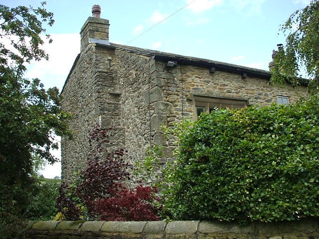
Farmhouse. C17. Rubble. Stone slate roof. 2 storeys. One 5-light and one 4-
light chamfered stone mullion window with moulded and returned dripstones. Two
4-light windows similar in first floor, left hand window replaced by moulded
concrete replica. Central doorway plain small square window above.
Listing NGR: SD8771247478
External links are from the relevant listing authority and, where applicable, Wikidata. Wikidata IDs may be related buildings as well as this specific building. If you want to add or update a link, you will need to do so by editing the Wikidata entry.


Other nearby listed buildings
