Latitude: 53.9234 / 53°55'24"N
Longitude: -2.1884 / 2°11'18"W
OS Eastings: 387721
OS Northings: 447485
OS Grid: SD877474
Mapcode National: GBR FR52.0B
Mapcode Global: WHB7C.CN34
Plus Code: 9C5VWRF6+8J
Entry Name: Barn Adjoining Mill Close Farmhouse
Listing Date: 5 July 1950
Grade: II
Source: Historic England
Source ID: 1361704
English Heritage Legacy ID: 186160
ID on this website: 101361704
SD 84 NE BARNOLDSWICK WEST CLOSE ROAD
3/28 Barn adjoining Mill Close
Farmhouse
5.7.50
- II
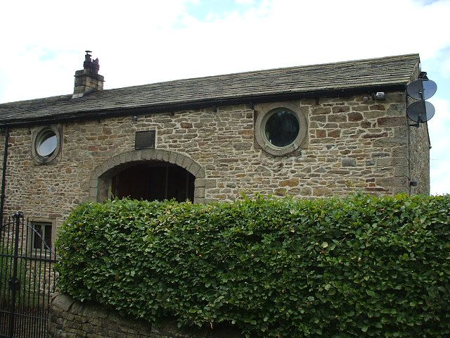
Barn, 1829. Rubble with stone slate roof. Segmental arch-headed doorway. Plaque
above inscribed, 'Rebuilt by the Rev Mordant Barnard, AD MDCCCXXIX'. Small square
window to left. 2 circular bullseye windows at eaves.
Listing NGR: SD8772147485
External links are from the relevant listing authority and, where applicable, Wikidata. Wikidata IDs may be related buildings as well as this specific building. If you want to add or update a link, you will need to do so by editing the Wikidata entry.


Other nearby listed buildings