Latitude: 52.7861 / 52°47'9"N
Longitude: -1.2412 / 1°14'28"W
OS Eastings: 451271
OS Northings: 321214
OS Grid: SK512212
Mapcode National: GBR 8KK.C0Q
Mapcode Global: WHDHP.X73G
Plus Code: 9C4WQQP5+CG
Entry Name: Ruins of All Saints Church
Listing Date: 15 March 1965
Last Amended: 5 November 1984
Grade: II
Source: Historic England
Source ID: 1074556
English Heritage Legacy ID: 189406
ID on this website: 101074556
Location: Dishley, Charnwood, Leicestershire, LE11
County: Leicestershire
District: Charnwood
Civil Parish: Hathern
Built-Up Area: Loughborough
Traditional County: Leicestershire
Lieutenancy Area (Ceremonial County): Leicestershire
Church of England Parish: Thorpe Acre with Dishley All Saints
Church of England Diocese: Leicester
SK 52 SW DERBY ROAD 2/35 DISHLEY (north side)
15.3.65 Ruins of All Saints Church (formerly listed as Ruins of Old Parish Church)
II
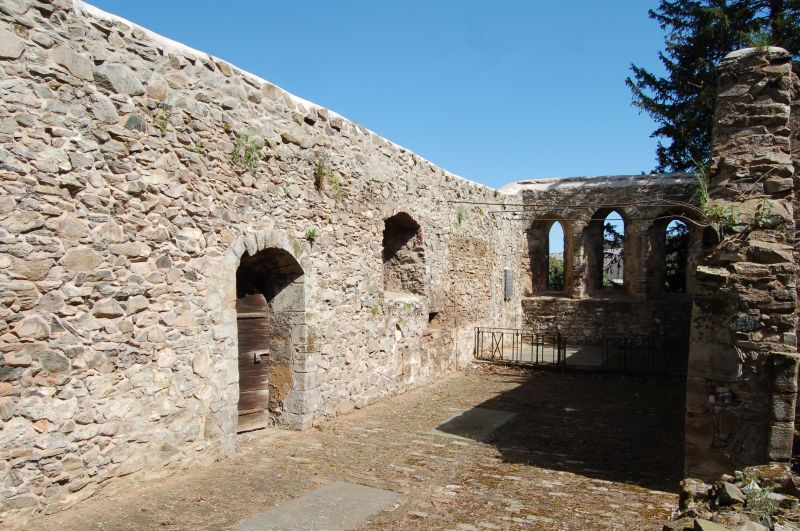
East, north and south walls of ruined aisle-less church, C12/C13; rubble stone with ashlar dressings. Triple lancet east window. North wall: round-headed doorway with semi-circular hoodmould, plank door. South wall (from east to west) lancet, blocked round-headed doorway, ogee-headed lancet, base of porch. Interior has remains of piscina, sedilia, aumbry. Slate grave slabs including those to the Bakewell family C20 slate slab commemorating Robert Bakewell on north wall.
Listing NGR: SK5127121214


Other nearby listed buildings