Latitude: 52.7863 / 52°47'10"N
Longitude: -1.2412 / 1°14'28"W
OS Eastings: 451270
OS Northings: 321239
OS Grid: SK512212
Mapcode National: GBR 8KK.C0N
Mapcode Global: WHDHP.X739
Plus Code: 9C4WQQP5+GG
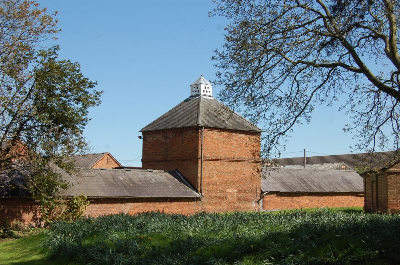
Entry Name: Dovecote, Dishley Grange Farmyard
Listing Date: 5 November 1984
Grade: II
Source: Historic England
Source ID: 1074514
English Heritage Legacy ID: 189408
ID on this website: 101074514
Location: Dishley, Charnwood, Leicestershire, LE11
County: Leicestershire
District: Charnwood
Civil Parish: Hathern
Built-Up Area: Loughborough
Traditional County: Leicestershire
Lieutenancy Area (Ceremonial County): Leicestershire
Church of England Parish: Thorpe Acre with Dishley All Saints
Church of England Diocese: Leicester
Tagged with: Dovecote
SK 52 SW DERBY ROAD
2/37 DISHLEY
(north side)
Dovecote, Dishley
Grange Farmyard
II
Dovecote, late C18, square plan, stone plinth, red brick with raided band, brick
dentil cornice, pyramidal slate roof, white painted lantern.
Listing NGR: SK5127021239
External links are from the relevant listing authority and, where applicable, Wikidata. Wikidata IDs may be related buildings as well as this specific building. If you want to add or update a link, you will need to do so by editing the Wikidata entry.


Other nearby listed buildings