Latitude: 53.5102 / 53°30'36"N
Longitude: -2.9434 / 2°56'36"W
OS Eastings: 337531
OS Northings: 401921
OS Grid: SD375019
Mapcode National: GBR 7WWV.KD
Mapcode Global: WH86V.R1K9
Plus Code: 9C5VG364+3J
Entry Name: Sundial Approximately 5 Metres to South of Maghull Chapel
Listing Date: 17 January 1986
Grade: II
Source: Historic England
Source ID: 1075841
English Heritage Legacy ID: 216499
ID on this website: 101075841
Location: St Andrew's Church, Maghull, Sefton, Merseyside, L31
County: Sefton
Civil Parish: Maghull
Built-Up Area: Maghull
Traditional County: Lancashire
Lieutenancy Area (Ceremonial County): Merseyside
Church of England Parish: Maghull St Andrew
Church of England Diocese: Liverpool
Tagged with: Sundial
MAGHULL DAMFIELD LANE
SD 30 SE
(south-west side)
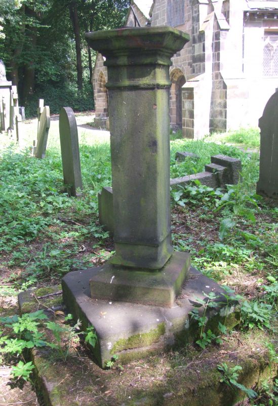
7/100 Sundial approx.
5 m. to south of
Maghull chapel
(q.v.) )
G.V. II
Sundial. 1827 with earlier plate. Stone square shaft with
moulded capital and base on 2 square steps.
Listing NGR: SD3753101921
External links are from the relevant listing authority and, where applicable, Wikidata. Wikidata IDs may be related buildings as well as this specific building. If you want to add or update a link, you will need to do so by editing the Wikidata entry.


Other nearby listed buildings