Approximate Location Map
Large Map »
Latitude: 52.4496 / 52°26'58"N
Longitude: -1.9687 / 1°58'7"W
OS Eastings: 402225
OS Northings: 283513
OS Grid: SP022835
Mapcode National: GBR 5JM.5S
Mapcode Global: VH9Z1.TPLJ
Plus Code: 9C4WC2XJ+RG
Entry Name: Harborne Home Barn and Farmbuildings Adjoining
Listing Date: 8 July 1982
Grade: II
Source: Historic England
Source ID: 1076250
English Heritage Legacy ID: 217465
ID on this website: 101076250
Location: Harborne Golf Course, California, Birmingham, West Midlands, B17
County: Birmingham
Parish: Non Civil Parish
Built-Up Area: Birmingham
Traditional County: Staffordshire
Lieutenancy Area (Ceremonial County): West Midlands
Church of England Parish: Harborne St Peter
Church of England Diocese: Birmingham
Tagged with: Building
NORTHFIELD ROAD
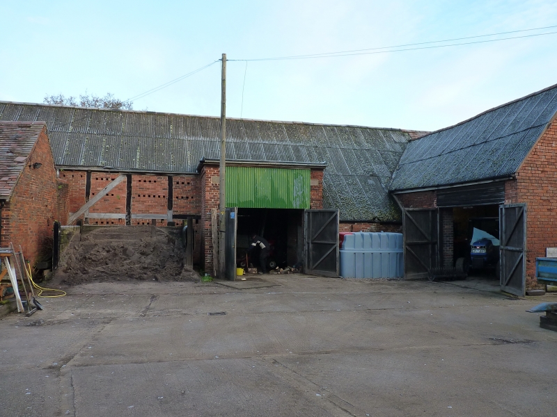
1.
5104 Harborne B17
Harborne Home Barn and
Farmbuildings adjoining
SP 08 SW 11/31
II GV
2.
Early C19. Grouped around a small yard and including a brick barn with tiled
roof. Three bays wide with central arched cart opening flanked on each side
by a single small entrance with ause-de-panier head. Air vents in decorative
patterns between the bays. Frieze at eaves level.
Listing NGR: SP0222583513
External links are from the relevant listing authority and, where applicable, Wikidata. Wikidata IDs may be related buildings as well as this specific building. If you want to add or update a link, you will need to do so by editing the Wikidata entry.


Other nearby listed buildings
