Approximate Location Map
Large Map »
Latitude: 52.389 / 52°23'20"N
Longitude: -1.7347 / 1°44'4"W
OS Eastings: 418151
OS Northings: 276806
OS Grid: SP181768
Mapcode National: GBR 4JG.67Q
Mapcode Global: VH9ZK.W69Y
Plus Code: 9C4W97Q8+H4
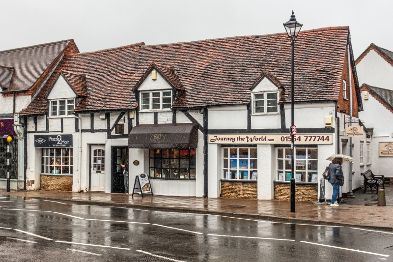
Entry Name: 1681, 1683 and 1683A, Warwick Road
Listing Date: 22 July 1976
Grade: II
Source: Historic England
Source ID: 1076703
English Heritage Legacy ID: 218324
ID on this website: 101076703
Location: Knowle, Solihull, West Midlands, B93
County: Solihull
Electoral Ward/Division: Knowle
Parish: Non Civil Parish
Built-Up Area: Solihull
Traditional County: Warwickshire
Lieutenancy Area (Ceremonial County): West Midlands
Church of England Parish: Knowle
Church of England Diocese: Birmingham
Tagged with: Building
SOLIHULL KNOWLE
1.
5108
(High Street)
WARWICK ROAD
(North-East Side)
Nos 1681 & 1683
No 1683A
SP 1876 20/43
II
2.
One building. C17, altered. Square timber framing, modern stucco on right. Roof
mainly of old tiles with 3 gabled lattice casement dormers. Red brick nogging,
1 storey and attics, 4 recessed shop bow windows.
Listing NGR: SP1814876811
External links are from the relevant listing authority and, where applicable, Wikidata. Wikidata IDs may be related buildings as well as this specific building. If you want to add or update a link, you will need to do so by editing the Wikidata entry.


Other nearby listed buildings
