Latitude: 52.4115 / 52°24'41"N
Longitude: -1.7733 / 1°46'23"W
OS Eastings: 415519
OS Northings: 279306
OS Grid: SP155793
Mapcode National: GBR 4J0.VXG
Mapcode Global: VH9ZC.6NX5
Plus Code: 9C4WC66G+JM
Entry Name: The Old Grammar School
Listing Date: 5 December 1949
Grade: II*
Source: Historic England
Source ID: 1076728
English Heritage Legacy ID: 218291
ID on this website: 101076728
Location: Solihull, West Midlands, B91
County: Solihull
Electoral Ward/Division: St Alphege
Parish: Non Civil Parish
Built-Up Area: Solihull
Traditional County: Warwickshire
Lieutenancy Area (Ceremonial County): West Midlands
Church of England Parish: Solihull
Church of England Diocese: Birmingham
Tagged with: School building
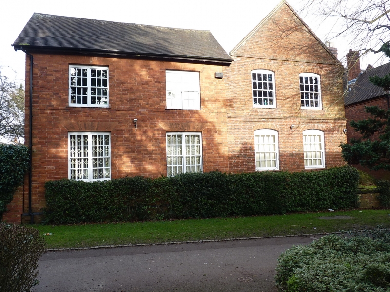
SOLIHULL PARK ROAD
1.
5108
(North Side)
No 29 (The Old
Grammar School)
SP 1579 1/455 5.12.49.
II*
2.
Otherwise known as Malvern House. Mid C18. Red brick, old tiled roof. 2 storeys
and attics with 2 storey 2 window gabled projections, with brick copings, either
side. Central 4 panel door in architrave surround with cornice on consoles. Sash
windows and some casements with wooden transoms. Mby incorporate earlier structure
of mid C17. Late C19 additions on left and at back.
Listing NGR: SP1551979306
External links are from the relevant listing authority and, where applicable, Wikidata. Wikidata IDs may be related buildings as well as this specific building. If you want to add or update a link, you will need to do so by editing the Wikidata entry.


Other nearby listed buildings