Latitude: 52.5156 / 52°30'56"N
Longitude: -2.005 / 2°0'18"W
OS Eastings: 399754
OS Northings: 290860
OS Grid: SO997908
Mapcode National: GBR 28W.63
Mapcode Global: VH9YV.61CB
Plus Code: 9C4VGX8V+7X
Entry Name: Barn Approximately 50 Metres West of Oak House
Listing Date: 10 November 1972
Grade: II
Source: Historic England
Source ID: 1077121
English Heritage Legacy ID: 219331
ID on this website: 101077121
Location: Lambert's End, Sandwell, West Midlands, B70
County: Sandwell
Electoral Ward/Division: Greets Green and Lyng
Parish: Non Civil Parish
Built-Up Area: West Bromwich
Traditional County: Staffordshire
Lieutenancy Area (Ceremonial County): West Midlands
Church of England Parish: West Bromwich Good Shepherd with St John
Church of England Diocese: Lichfield
Tagged with: Barn
SANDWELL MB OAK ROAD, West Bromwich SO 99 SE 4/119 Barn approximately 50 metres west of Oak House 10.11.72 GV II
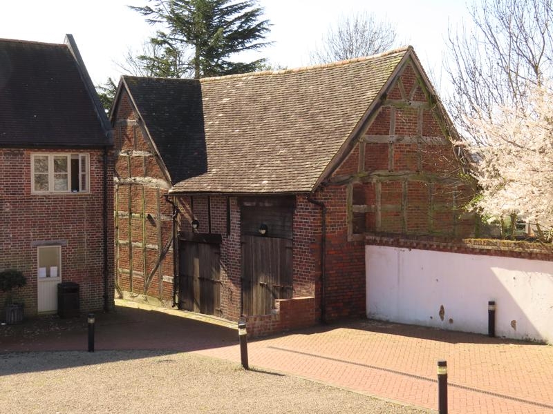
Agricultural building, now workshop and store. C17. Timber-framed with brick in fill. Comprises a south range and a wing at right angles extending to the north which appears to be of the same build. The east gable wall of the south range has exposed framing in square panels, tension braces, and a truss with tie-beam, two collars, and side purlins. The principal posts have redundant mortices which suggest that this range once extended further to the east. This shortening must have happened before the adjacent barn (qv) was built to the east. The east wall of the rear wing has had some of its stud- work removed and has two wide modern workshop doors. The west wall of the front range and the north wall of the rear wing both have tie-beam trusses with two collars with V-struts above the upper collar. Interior of the front range is undivided and open to the roof and is of two bays. The open truss has raking struts. One straight brace remains from the tie-beam to a principal post. The wind-braces are slightly curved. Interior of rear wing not accessible at time of survey.
Listing NGR: SO9975490860
External links are from the relevant listing authority and, where applicable, Wikidata. Wikidata IDs may be related buildings as well as this specific building. If you want to add or update a link, you will need to do so by editing the Wikidata entry.


Other nearby listed buildings