Latitude: 52.5156 / 52°30'56"N
Longitude: -2.0047 / 2°0'17"W
OS Eastings: 399774
OS Northings: 290852
OS Grid: SO997908
Mapcode National: GBR 28W.83
Mapcode Global: VH9YV.61JD
Plus Code: 9C4VGX8W+64
Entry Name: Barn Approximately 20 Metres West of Oak House
Listing Date: 27 October 1972
Grade: II
Source: Historic England
Source ID: 1228237
English Heritage Legacy ID: 219330
ID on this website: 101228237
Location: Lambert's End, Sandwell, West Midlands, B70
County: Sandwell
Electoral Ward/Division: Greets Green and Lyng
Parish: Non Civil Parish
Built-Up Area: West Bromwich
Traditional County: Staffordshire
Lieutenancy Area (Ceremonial County): West Midlands
Church of England Parish: West Bromwich Good Shepherd with St John
Church of England Diocese: Lichfield
Tagged with: Barn
SANDWELL MB OAK ROAD, West Bromwich SO 99 SE 4/118 Barn approximately 20 metres west of Oak House 27.10.72 GV II
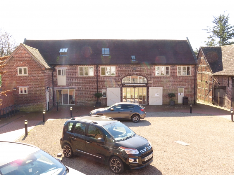
Barn, now workshop. Late C18. Brick in Flemish bond with tile roof. The wide cart entrance has an elliptical brick arch with stone impost blocks. At the left of the facade is a wide inserted doorway with steel lintel. To its left a lower gabled wing projects forwards. The right-hand part of the facade is covered by a single-storey modern lean-to. To each side of the main entrance, at first floor level, are two modern timber casement windows. Brick dentil course and gable openings. Interior has brick walls to each side of cart entrance. There are two trusses visible, with tie-beams and raking queen-struts. Some of the roof timber has been re-used from a timber-framed building of similar type to the barn adjoining to the west (qv).
Listing NGR: SO9977490852
External links are from the relevant listing authority and, where applicable, Wikidata. Wikidata IDs may be related buildings as well as this specific building. If you want to add or update a link, you will need to do so by editing the Wikidata entry.


Other nearby listed buildings