Latitude: 52.4981 / 52°29'53"N
Longitude: -1.973 / 1°58'22"W
OS Eastings: 401926
OS Northings: 288913
OS Grid: SP019889
Mapcode National: GBR 5H2.6C
Mapcode Global: VH9YV.RG9S
Plus Code: 9C4WF2XG+6Q
Entry Name: Smethwick New Pumping House Approximately 50 Metres North West of Brasshouse Lane Birmingham Canal Birmingham Level
Listing Date: 29 December 1978
Grade: II
Source: Historic England
Source ID: 1077154
English Heritage Legacy ID: 219213
ID on this website: 101077154
Location: Sandwell, West Midlands, B66
County: Sandwell
Electoral Ward/Division: Smethwick
Parish: Non Civil Parish
Built-Up Area: Smethwick
Traditional County: Staffordshire
Lieutenancy Area (Ceremonial County): West Midlands
Church of England Parish: Smethwick The Resurrection
Church of England Diocese: Birmingham
Tagged with: Building
SANDWELL MB BIRMINGHAM CANAL SP 0188 NE Birmingham Level, Smethwick 19/14 Smethwick new Pumping House approximately 50 metres 29.12.78 north-west of Brasshouse Lane
II
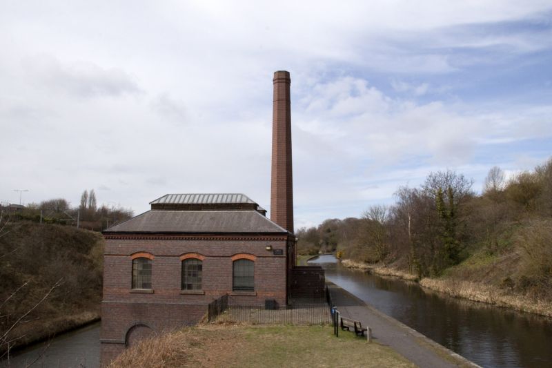
Pumping house between Smeaton's Old Main Line on the Wolverhampton Level and Telford's New Main Line on the Birmingham Level. 1892. Brick with slate roof. One storey to Old Main Line and two storeys to New Main Line. Lower storey has four-bay blind arcade with impost band, and a smaller doorway within right-hand arch. The upper storey has four windows with segmental heads, the two right-hand ones blocked, and a drip course. Miniature false machicolation to the eaves; adjoining to the left is the ashes hole with a doorway for removing the ash. Hipped slate roof in two spans, with louvred ridge ventilators. Right- hand return wall of three bays, with blocked windows. North-east wall, facing upper level, has two wide elliptical arches with smaller inner segmental arches. The right-hand one is blocked, the left-hand one is a doorway. In front of the right-hand archway are the foundation walls of the coal hole. Interior: steel roof trusses. History: This pumping house replaced two earlier pumping stations on the Engine Arm of the Birmingham Canal. It was the last to be erected on this section of the canal and housed two vertical compound engines driving centrifugal pumps capable of lifting 200 locks per day. In 1905 one engine was removed for use at Bentley, the remaining one being in use until the early 1920s. The pumphouse is a prominent feature of the canalside landscape.
Listing NGR: SP0192688913
External links are from the relevant listing authority and, where applicable, Wikidata. Wikidata IDs may be related buildings as well as this specific building. If you want to add or update a link, you will need to do so by editing the Wikidata entry.


Other nearby listed buildings