Latitude: 51.5723 / 51°34'20"N
Longitude: -0.3376 / 0°20'15"W
OS Eastings: 515305
OS Northings: 187244
OS Grid: TQ153872
Mapcode National: GBR 63.PKQ
Mapcode Global: VHGQH.3RD1
Plus Code: 9C3XHMC6+WX
Entry Name: 7, High Street
Listing Date: 21 September 1951
Grade: II
Source: Historic England
Source ID: 1079689
English Heritage Legacy ID: 202073
ID on this website: 101079689
Location: Harrow, London, HA1
County: London
District: Harrow
Electoral Ward/Division: Harrow on the Hill
Parish: Non Civil Parish
Built-Up Area: Harrow
Traditional County: Middlesex
Lieutenancy Area (Ceremonial County): Greater London
Church of England Parish: St Mary Harrow-on-the-Hill
Church of England Diocese: London
Tagged with: Building
HIGH STREET
1.
5016
(east side)
Harrow-on-the-Hill
No 7
TQ 1587 SW 16/44 21.9.51
II
2.
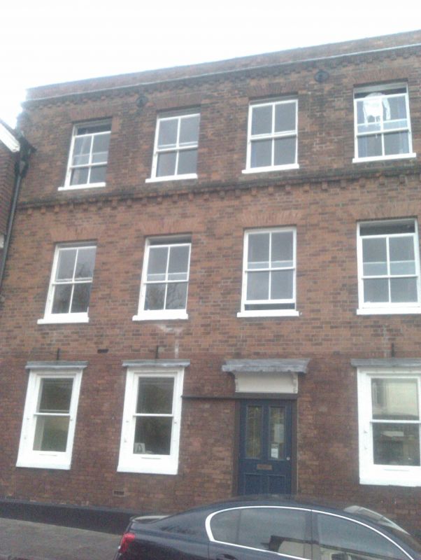
Mid C18. Three-storeys. Red brick. Four C19 sash windows, but original flush frames
on ground floor. Brick dentil string course and cornice. Parts of upper storeys
have been rebuilt.
Listing NGR: TQ1530987241
External links are from the relevant listing authority and, where applicable, Wikidata. Wikidata IDs may be related buildings as well as this specific building. If you want to add or update a link, you will need to do so by editing the Wikidata entry.


Other nearby listed buildings