Latitude: 51.5721 / 51°34'19"N
Longitude: -0.3379 / 0°20'16"W
OS Eastings: 515287
OS Northings: 187228
OS Grid: TQ152872
Mapcode National: GBR 63.PHL
Mapcode Global: VHGQH.3R75
Plus Code: 9C3XHMC6+VV
Entry Name: Moretons
Listing Date: 24 February 1982
Grade: II
Source: Historic England
Source ID: 1079690
English Heritage Legacy ID: 202074
ID on this website: 101079690
Location: Harrow, London, HA1
County: London
District: Harrow
Electoral Ward/Division: Harrow on the Hill
Parish: Non Civil Parish
Built-Up Area: Harrow
Traditional County: Middlesex
Lieutenancy Area (Ceremonial County): Greater London
Church of England Parish: St Mary Harrow-on-the-Hill
Church of England Diocese: London
Tagged with: Building
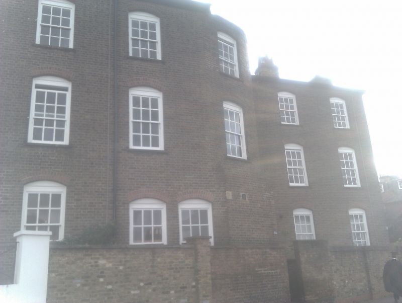
HIGH STREET
1.
5016 (east side)
Harrow-on-the-Hill
No 9
(Moretons)
TQ 1587 SW 16/45 24.2.82
II GV
2.
Late C18 with later stucco. Three-storeys. Three bays. Heavy arched porch to left,
on square pillars. Additions to left (stuccoed) and right (brick).
Listing NGR: TQ1529287234
External links are from the relevant listing authority and, where applicable, Wikidata. Wikidata IDs may be related buildings as well as this specific building. If you want to add or update a link, you will need to do so by editing the Wikidata entry.


Other nearby listed buildings