Approximate Location Map
Large Map »
Latitude: 51.5717 / 51°34'18"N
Longitude: -0.3383 / 0°20'18"W
OS Eastings: 515254
OS Northings: 187181
OS Grid: TQ152871
Mapcode National: GBR 63.PCB
Mapcode Global: VHGQH.2RZH
Plus Code: 9C3XHMC6+MM
Entry Name: Flambards
Listing Date: 21 September 1951
Grade: II
Source: Historic England
Source ID: 1358628
English Heritage Legacy ID: 202075
ID on this website: 101358628
Location: Harrow, London, HA1
County: London
District: Harrow
Electoral Ward/Division: Harrow on the Hill
Parish: Non Civil Parish
Built-Up Area: Harrow
Traditional County: Middlesex
Lieutenancy Area (Ceremonial County): Greater London
Church of England Parish: St Mary Harrow-on-the-Hill
Church of England Diocese: London
Tagged with: Building
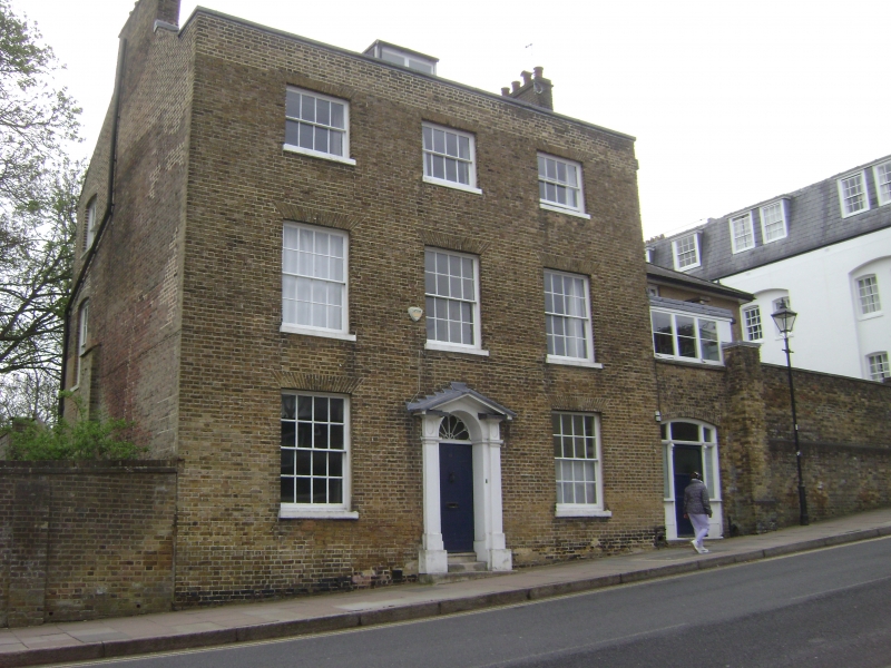
HIGH STREET
1.
5016
(east side)
Harrow-on-the-Hill
No 11
(Flambards)
TQ 1587 SW 16/46 21.9.51
II GV
2.
Late C18. Three-storeys. Yellow brick. Three windows. Pedimented doorcase with
fluted pilasters and good fanlight.
Listing NGR: TQ1525787180
External links are from the relevant listing authority and, where applicable, Wikidata. Wikidata IDs may be related buildings as well as this specific building. If you want to add or update a link, you will need to do so by editing the Wikidata entry.


Other nearby listed buildings
