Latitude: 51.5719 / 51°34'18"N
Longitude: -0.3386 / 0°20'19"W
OS Eastings: 515234
OS Northings: 187202
OS Grid: TQ152872
Mapcode National: GBR 63.P92
Mapcode Global: VHGQH.2RVB
Plus Code: 9C3XHMC6+QG
Entry Name: 46, High Street
Listing Date: 25 May 1983
Grade: II
Source: Historic England
Source ID: 1079695
English Heritage Legacy ID: 202084
ID on this website: 101079695
Location: Harrow, London, HA1
County: London
District: Harrow
Electoral Ward/Division: Harrow on the Hill
Parish: Non Civil Parish
Built-Up Area: Harrow
Traditional County: Middlesex
Lieutenancy Area (Ceremonial County): Greater London
Church of England Parish: St Mary Harrow-on-the-Hill
Church of England Diocese: London
Tagged with: Building
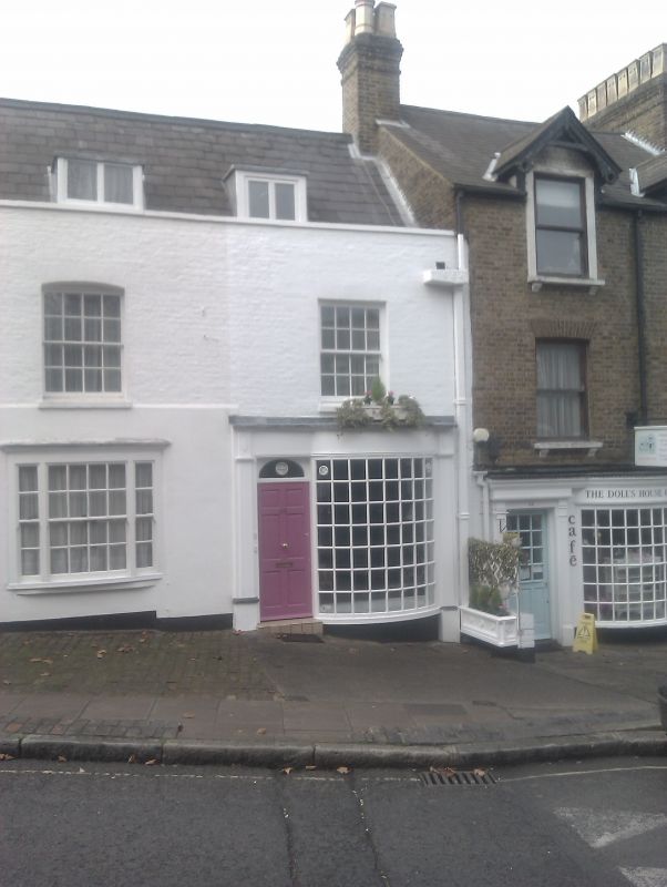
HIGH STREET
1.
5016
(west side)
Harrow-on-the-Hill
No 46
TQ 1587 SW 16/27
II GV
2.
Mid C19. Painted. Two-storeys. One 4-bay with modern shopfront and flanking
door left. Slate roof with casement dormer. Forms part of No 48 and is evidently
internally, a continuation of this timber-framed range. Rainwater head dated 1964.
Listing NGR: TQ1523487198
External links are from the relevant listing authority and, where applicable, Wikidata. Wikidata IDs may be related buildings as well as this specific building. If you want to add or update a link, you will need to do so by editing the Wikidata entry.


Other nearby listed buildings